Large-Extent Tsunami Evacuation Maps
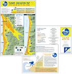
If you live at or visit the Oregon coast, this information may save your life. Take time to practice your tsunami evacuation plan and route.
The tsunami inundation limits shown on maps listed below represent the worst case scenarios for tsunamis generated from local (Cascadia subduction zone) and distant earthquakes. Note that the local zone extends under the distant zone on these maps.
Looking for a smaller-area map that you can print on your printer?
See the Detailed, Neighboorhood-Specific Evacuation Maps series:
Curry County,
Douglas County,
Lincoln County. Other counties coming soon.
Don't see your area in a map? Make a custom map.
If you live outside the extents shown on the maps, don't worry.
Use the NANOOS evacuation zone web map viewer to type in an address or to see areas not included on the maps here. Then you can print a custom tsunami evacuation map for your area.
Large-Extent Evacuation Maps (bigger than 8.5 x 11 inch page size) Note that the local zone extends under the distant zone on these maps. You can use the
DOGAMI evacuation maps interactive map to see all the maps listed below.
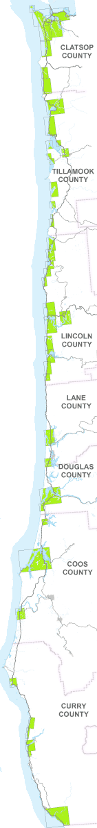 North to South:
- Clatsop County
- Tillamook County
- Lincoln County
- Lane County
- Douglas County
- Coos County
- Curry County
Last updated June 17, 2022