Framework Program Themes
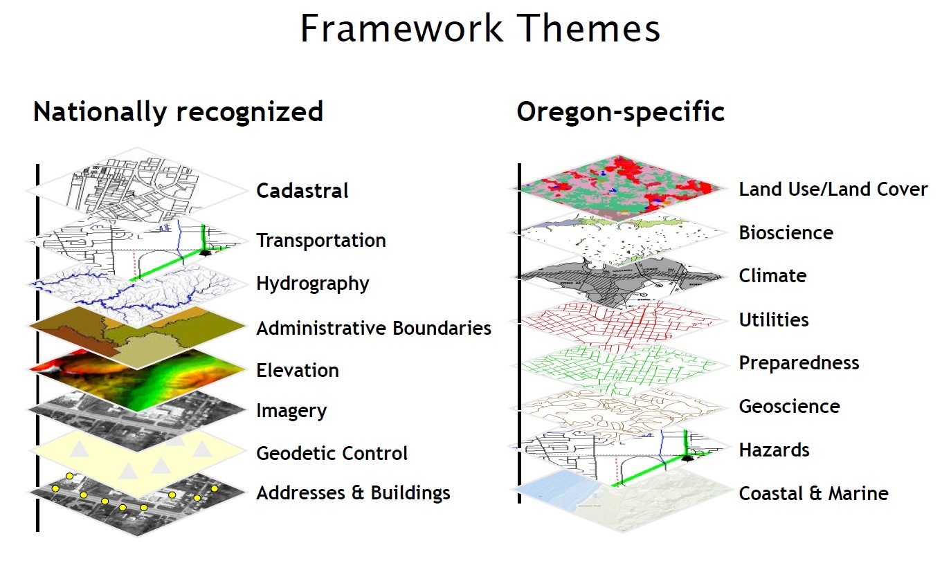
The Framework Program data and activities are organized into 16 themes based on subject matter. Each theme consists of a Framework Implementation Team, or FIT. FITs are made of up volunteers across government agencies, private industry, and the public who have expertise in their fields. Dividing data elements into themes based on subject matters allows the subject matter experts to stay closely tied to their fields of study.
The theme-based approach encourages engagement with people with varying backgrounds within a field. This diversity of skills and backgrounds helps to ensure that Framework data is meeting a wide range of user needs.
Framework datasets are selected by consensus and reviewed annually in a process that includes coordination between the FITs, the Oregon Geographic Information Council, and the public.
Find out more about the
16 Framework Themes on GEOHub
What are the criteria for geospatial Framework data?
| Requirements | Description |
|---|
| Multiple, well-defined use cases | Multiple, well-defined business uses that articulate the importance of the creation and long-term maintenance of the data. |
| Multiple, well-defined users | Well-defined set of users or organizations/agencies who rely on the data for their business needs. |
| Authoritative Data | Data that are provided by an entity officially authorized to create it or based on scientific methodology, technical standards or expertise. |
| Statewide | Statewide datasets are the goal, however, may require aggregation of many sub-sets/jurisdictional data. |
| - OR - |
| Required by Legislation | Data required in statute for agencies to acquire and maintain. |