Oregon Coordinate Systems
Ten different major map projections have been commonly used in Oregon and all have varied error across the state. A common projection for statewide data display, analysis, publishing, and transfer was needed so the
Oregon Geographic Information Council endorsed the use of Oregon Lambert as a standard for state agencies.
Oregon Lambert is registered in the EPSG Geodetic Parameter Dataset by the International Association of Oil and Gas Producers (IOGP) Geomatics Committee, which maintains and publishes an international coordinate reference system database. The EPSG spatial reference ID for Oregon Lambert is
2992.
Oregon also supports the use of the
Oregon Coordinate Reference System which is a low distortion projection system stewarded by the
Oregon Department of Transportation. See the OCRS Handbook and User Guide for more information.
Coordinate Reference System Description
-
Projection: LAMBERT CONIC CONFORMAL
-
Datum: NAD83
-
Units: INTERNATIONAL FEET, 3.28084 (0.3048 METERS)
-
Spheroid: GRS1980
Parameters
-
1st Standard Parallel: 43 00 0.000
-
2nd Standard Parallel: 45 30 0.000
-
Central Meridian: -120 30 0.000
-
Latitude of Projection's Origin: 41 45 0.000
-
False Easting: 1,312,335.958 Feet
-
False Northing: 0.00000 Feet
Conversion Notes:
- US Survey foot = 1200/3937 meters (0.3048006096 m).
- International foot = 0.3048 m exactly
- 1 meter = 3.28084 Intl. feet
Oregon Lambert History
Oregon GIS Program Leaders (GPL) formed a committee to evaluate and recommend a common projection for data display, analysis, publishing, and transfer for Oregon. The committee was comprised of representatives from the DAS/IRMD Geospatial Enterprise Office (SSCGIS), the Oregon Department of Transportation (ODOT), the Oregon Department of Forestry (ODF), the Oregon Department of Environmental Quality (DEQ), and the Oregon Department of Geology and Mineral Industries (DOGAMI).
Additionally, other organizations within the state were consulted. The committee reviewed projections in use, compared how neighboring states deal with similar issues, and calculated projection errors. They submitted a
recommendation for an Oregon Projection/Coordinate System Standard to the Oregon Geographic Information Council (OGIC) who endorsed Oregon Lambert as the coordinate system standard for use by State of Oregon agencies.
Oregon Lambert Methodology
The total change in latitude for the state was calculated and then the standard parallels were set at 1/6th of the change north of the minimum and 1/6th of the change south of the maximum. The final values for the standard parallels were rounded to even or half degrees. The central meridian was set at 120 degrees 30', the midpoint east to west of the state. The origin was shifted 400,000 meters to the west to put the entire state in the positive quadrant.
Error Statistics
Oregon Lambert Error Statistics - Minimum, maximum, and mean percentage errors for each map projection.
Images Showing Calculated Percentage Error
The maps below were created from error statistic calculations based on formulas in Map Projections - A Working Manual by John Snyder, USGS Professional Paper 1385, 1987. Each "cell" is a 7.5' USGS quad.
Oregon Lambert, North American Datum of 1983, International Feet
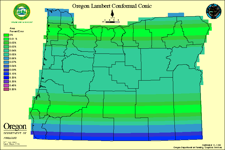 Percent errors (by area) map of Oregon Lambert, North American Datum of 1983, international feet coordinate system.
US Lambert, North American Datum of 1983, Meters
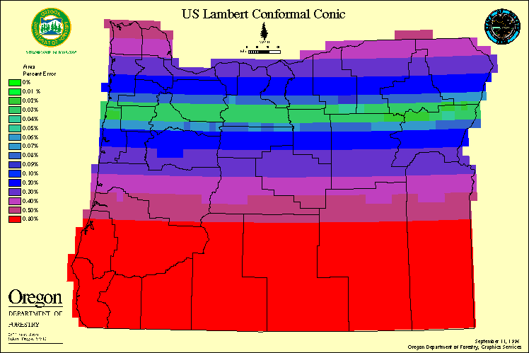 Percent errors (by area) map of US Lambert, North American Datum of 1983, meters coordinate system.
US Lambert, North American Datum of 1983, Meters
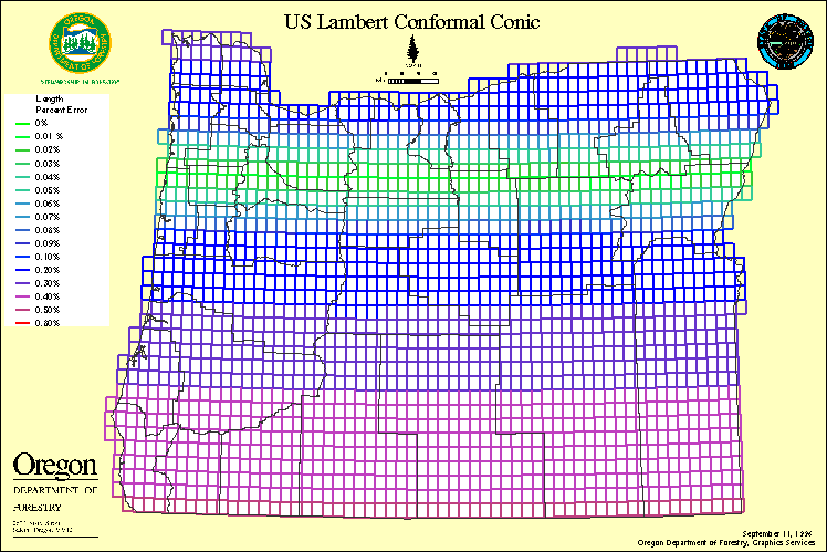 Percent errors (by area) map of US Lambert, North American Datum of 1983, meters coordinate system.
Oregon State Plane North Zone, North American Datum of 1983, International Feet
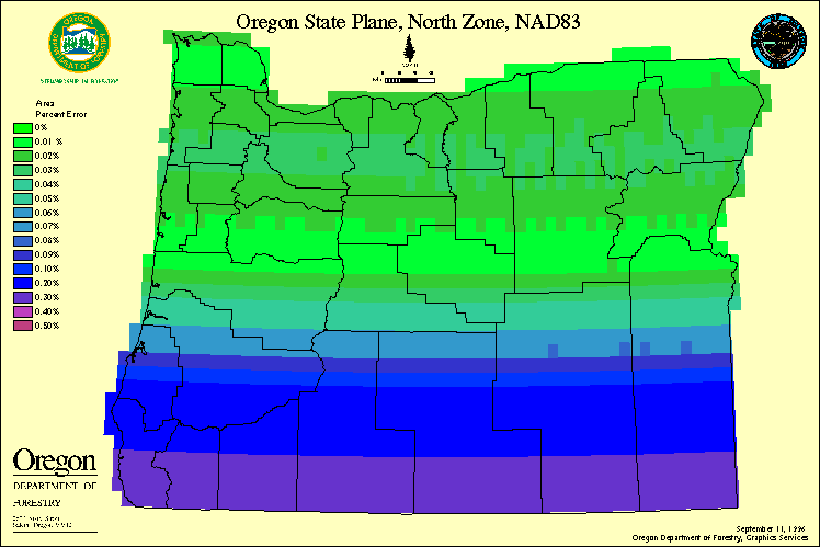 Percent errors (by area) map of Oregon State Plan North Zone, North American Datum of 1983, international feet coordinate system.
Oregon State Plane North Zone, North American Datum of 1983, International Feet
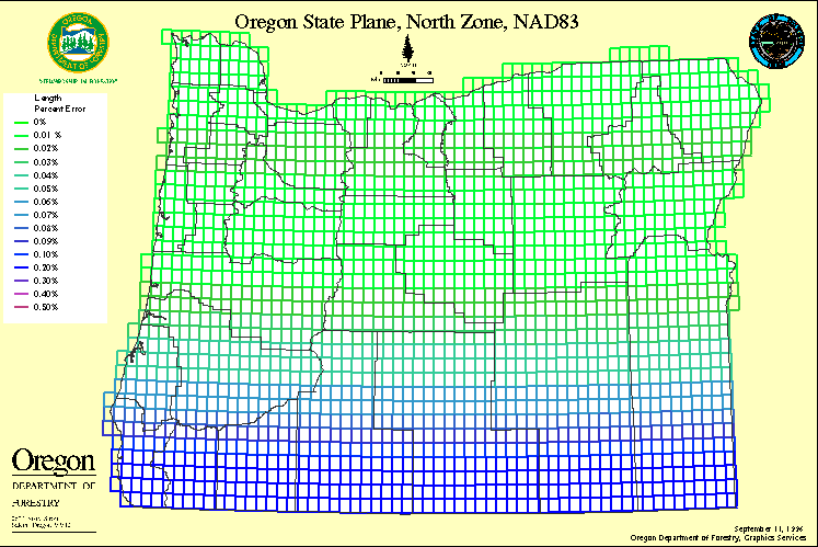 Percent errors (by length) map of Oregon State Plan North Zone, North American Datum of 1983, international feet coordinate system.
Universal Transverse Mercator, North American Datum of 1983, Meters
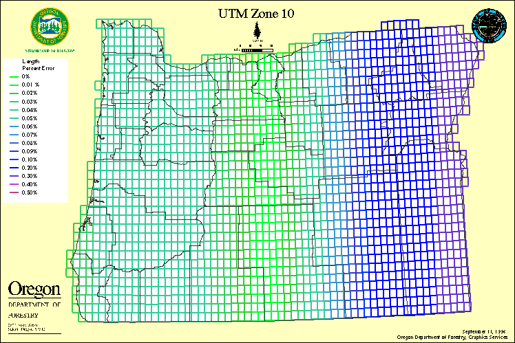 Percent errors (by length) map of Universal Transverse Mercator, North America Datum of 1983, meters coordinate system.
Oregon Albers, North American Datum of 1983, Meters
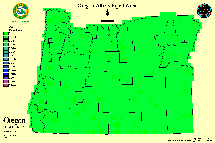 Percent errors (by area) map of Oregon Albers, North America Datum of 1983, meters coordinate system.
Oregon Albers, North American Datum of 1983, Meters
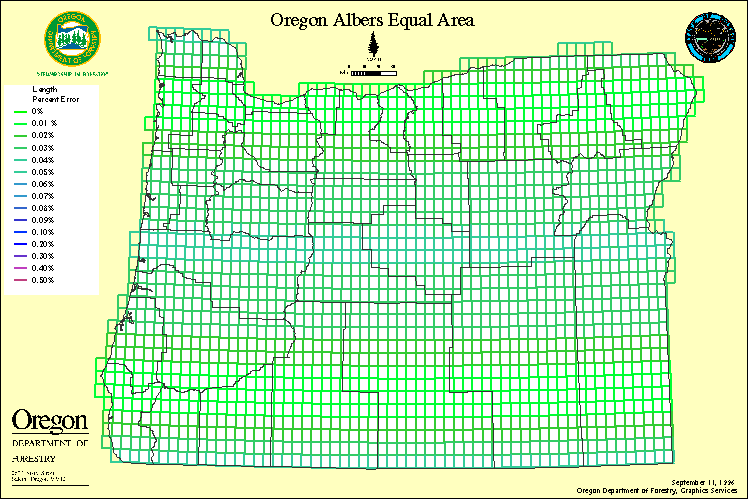 Percent errors (by length) map of Oregon Albers, North America Datum of 1983, meters coordinate system.