Welcome to "The King of Roads"
Imagine crafting a national treasure on a landscape so beautiful that each viewpoint is protected and people come from all over the world to marvel at its perfection. This is the Historic Columbia River Highway. Whether you are seeing it for the first time or you know every inch by heart, each time you drive, bike, or hike along the Historic Highway, you begin the journey anew.
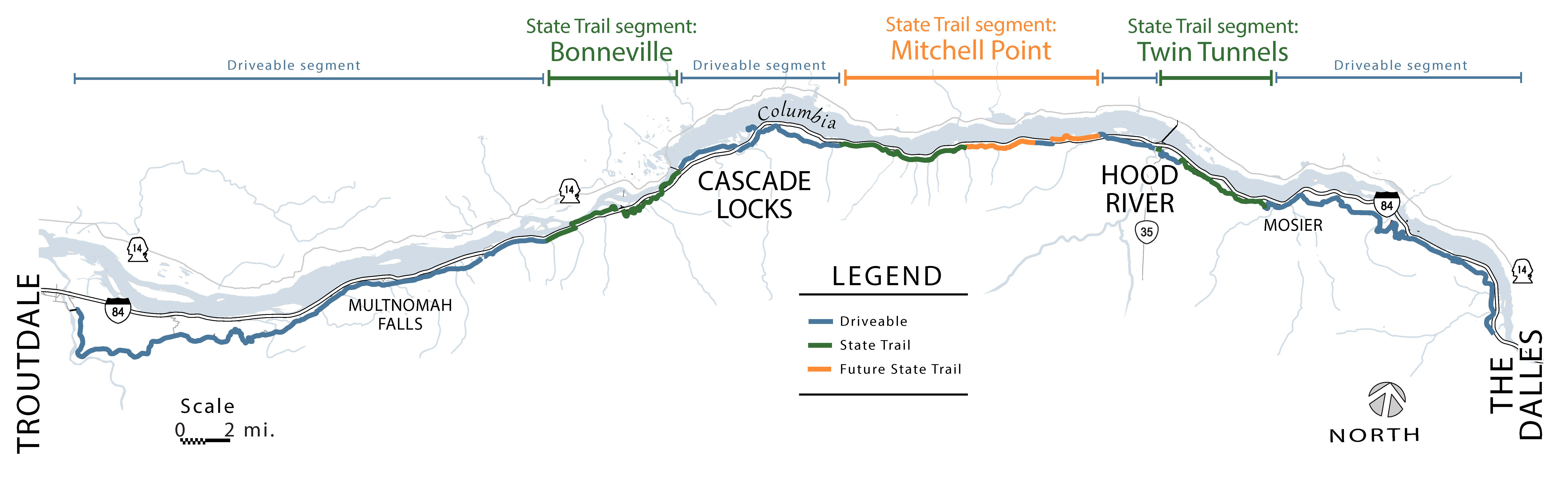
The Historic Highway is owned and managed by the Oregon Department of Transportation. Oregon Parks and Recreation Department manages the State Trail in partnership with ODOT.
Visiting the Historic Highway and State Trail
The Highway was left partially intact after Interstate 84 was built, with the middle section cut into pieces or partially destroyed. Efforts are underway to create vehicle-free paths for cyclists and pedestrians, transforming the abandoned sections into the Historic Columbia River Highway State Trail.
Learn where you can drive, bike, and hike on the Historic Columbia River Highway and State Trail. Explore the three unique zones: Waterfall, Columbia River, and High Plateau.
State Trail Construction
The iconic Mitchell Point Tunnel was a highlight of the original Historic Highway, but the construction of Interstate 84 destroyed the tunnel.
In spring 2021, we broke ground on a new tunnel and Historic Highway State Trail segment. The 655-foot tunnel with five arched windows reminiscent of the original tunnel at Mitchell Point is scheduled to open in 2024.