
Oregon State Flag An official website of the State of Oregon »

ODOT History

In 2013, the Oregon Department of Transportation celebrated its 100th anniversary. During that “century of service,” the department has seen dramatic changes in the way we travel and the routes we travel on. From horse-drawn road scrapers to today’s computer-operated machinery and solar highways, the people, events and technology that have molded the paths we’ve taken each have a unique story to tell.

Join us to explore some glimpses of Oregon transportation history!

Getting Oregon Out of the Mud

Portrait of Governor Oswald West By the early 1900s, the need for an improved road system in Oregon was apparent. Few roads existed to connect the small communities along the coast. The expansion of the railroad had eliminated large portions of the primitive wagon road providing access through the Columbia River Gorge. Roadways in the western portions of the state became a sea of mud when the winter rains began to fall. The introduction of the automobile, bicycle groups and the “Good Roads” movement increased pressure on the Oregon legislature to find solutions. In 1913, the legislature formed the State Highway Commission giving them the mandate to, “Get Oregon out of the mud!”

The Commission originally consisted of Governor Oswald West, Secretary of State Ben Olcott and State Treasurer Thomas Kay. This body appointed Major Henry Bowlby as the first State Highway Engineer.

Growing Pains

The early years were tumultuous, with a clash of visions, and a struggle to standardize practices. Major Bowlby stated in the First Annual Report of the Highway Engineer (1914): “Naturally, there has been and is opposition to the existence of a State Highway Department. This opposition is, I believe, felt by two classes: Those who are ignorant of its purpose and its true function in the road scheme of a state, and by those who feel that they have lost something because of its existence”. However, Bowlby also acknowledged that there had been helpful cooperation between the Commission, the counties, the taxpayers and the press. Indeed, the press followed the work – and sometimes the drama – of the agency closely.

Finding our Way

By 1917, the Commission was reorganized to include three Governor-appointed members, one from each of the congressional districts in the state. The system of state highways had been laid out and approved, and the agency was developing into a true highway department. The Highway Commission began to issue contracts and build a work force. By the end of 1918,the Highway Department consisted of 79 employees, including Highway Engineer Herbert Nunn.

  • Contract #1 was awarded on June 19th, 1917, to the Elliott Contracting Co. of Portland, OR for the Cummins Hill Section of the John Day Highway in Wheeler County.

Beaches as State Highways

Governor Oswald West, Chairman of the first Highway Commission, observed that beaches along the coast were used routinely for travel and petitioned to have the entire Oregon Coast declared part of the highway system. The resulting 1913 statute paved the way for today’s public access to all beaches in Oregon.

A Transportation Barrier

Columbia River Highway The Columbia River Gorge, with its beautiful but rugged terrain, had been a difficult transportation corridor for early travelers and settlers heading west to the Willamette Valley. A primitive wagon road was cut through the Gorge in the 1850s, but was effectively destroyed when railroad tracks were laid in the 1880s.

But railroad tycoon Sam Hill and engineer Sam Lancaster toured the scenic highways of Europe, and formed a vision of creating a similar route through the Gorge.

Making the Vision a Reality

Hill asked Lancaster to construct an experimental roadway at Hill's Maryhill Estate, on the Washington side of the Columbia. This roadway was used to demonstrate what could be accomplished through careful engineering. State and county officials, as well as private entrepreneurs, were impressed enough to provide support and backing to begin the grand project.

Constructing a Highway

Sam Lancaster was determined to maximize the scenic effect of the highway by charting the alignment close to as many of the Gorge's signature waterfalls, canyons, cliffs and mountain domes as possible. ​Much of the work on the CRH was done by hand, and with horse-drawn wagons and equipment. Some larger equipment was also used, including steam shovels and early dump trucks. While Lancaster served as the consulting engineer, surveying and overseeing the construction in Multnomah County, a former student of his, John Arthur Elliot, was hired to do the same in Hood River and Wasco Counties. One of the challenges he faced in Hood River was to site a tunnel in order to eliminate steep grades in the area of Mitchell Point. The result was the multi-windowed Mitchell Point Tunnel, based on the Axenstrasse tunnel in Switzerland. He discussed the logistics of planning the tunnel in his 1914 report. Elliot also designed the Mosier Twin Tunnels in Wasco County.

Skilled Italian stonemasons were hired to create many of the stunning rock walls, bridges and barriers found throughout the length of the highway.

The Columbia River Highway was dedicated on June 7, 1916, and was considered to be the first scenic highway in the United States. Lancaster's engineering standards had resulted in five percent grades, and curves with a minimum of 24-foot widths and 100 foot radiuses. This allowed for safe, easy travel as visitors flocked to take in the beauty of the Gorge.

As automobiles evolved, and traffic volumes and speeds increased, the Columbia River Highway became impractical and obsolete. Large portions fell into disuse following the construction of the lower water-level highway. However, efforts to restore the highway in recent years have opened most of the original route, either as roadways or as bicycle and pedestrian trails.

Learn More

Columbia River Highway Centennial 1916-2016 Logo Friend, E. M., & Hardham, J. (2016). King of roads. The Dalles, OR: Wasco County Historical Museum Press.

Mershon, C. E. (2006). The Columbia River Highway: from the sea to the wheat fields of eastern Oregon. Portland, OR: Guardian Peaks Enterprises.

State of Oregon, Office of State Highway Engineer (1914). First Annual Report of the Highway Engineer, Salem, OR: State Printing Department.

Links

A Poem in Stone: Celebrating the Historic Columbia River Highway, from the Oregon State Library

Historic Columbia River Highway

Oregon 1936 Road Map Cover The early focus of the Oregon State Highway Commission was to create a system of state highways that allowed residents to travel easily from one part of the state to another, and allowed farmers to haul their produce to market areas. However, the Commission acknowledged that having access to improved roadways also provided better access for the many scenic areas within the state. Encouraging visitors to visit these areas was seen as a potentially important source of revenue for the state and the Highway Department.

The Columbia River Highway, completed in 1916, was considered the first scenic highway in the country, and attracted travelers with its breath-taking views of the Columbia River Gorge.

When Governor Oswald West declared all Oregon beaches to be part of the State Highway system, he paved the way for beaches to be used, not only for travel, but for entertainment, as well. As automobiles became more common, people began to travel for the sake of travelling, bringing tourist dollars with them.

Keeping the Roadways Green and Building Parks

The Commission encouraged a program of planting trees along the highways, preserving existing bands of standing timber along both sides of the roadways, and acquiring land that provided visiting tourists with areas for picnicking and camping.

The 1921 legislature authorized the Highway Commission to acquire rights of way within 300 feet of the highway center line, which allowed for the retention of forest strips, and the further development of waysides and small roadside parks.

In 1925, the Commission’s ability to obtain land and develop parks and recreational areas was expanded. The number and size of state parks increased from 4,070 acres in 1927 to approximately 60,000 acres in 1950.

  • Much of the land developed for the park system was donated by private citizens. The first such tract was on the Westside Pacific Highway near Monmouth in 1922, given to the Commission by the Helmick family to be designated as the Sarah Helmick State Park.
  • Sam Boardman served as the State Parks Engineer from 1929 to 1950. His dynamic leadership was instrumental in the growth of the State Parks system.
  • The Oregon State Park system remained a part of the Oregon State Highway Department until it separated to become the Oregon Department of Parks and Recreation in 1990.

​Travel and Information Division

The Travel and Information Division was formed in November, 1935, launching a nation-wide advertising and publicity campaign to promote tourism using the state's highway system. Photographer Ralph Gifford was hired to document scenic wonders across the state, becoming the first agency photographer, and scenic photos accompanied advertisements in magazines and journals. Colorful brochures also encouraged tourists to visit Oregon.

  • Gifford had a background in motion pictures as well, and his production of the publicity film The New Oregon Trail was widely distributed across the country.

This advertising campaign was so successful that the Sixteenth Biennial Report of the Oregon State Highway Commission 1943-1944 reported that between the time of the Division’s formation in 1935 to Pearl Harbor, ushering in the US involvement in WWII, “tourist travel in Oregon increased over 50 per cent, becoming the third largest business in the state from the standpoint of income.”

Conde McCullough

Magnificent Arches

The Oregon Coast Highway is well known for the many spectacular bridges spanning waterways along the route. More than one of these owes its artistic design to Oregon's master bridge engineer Conde McCullough. Between the years of 1934 and 1936, then-Assistant State Bridge Engineer McCullough directed the design and construction of five of the major coastal bridges, including the Yaquina Bay Bridge in Newport, the Alsea Bay Bridge at Waldport, the Siuslaw River Bridge at Florence, the Umpqua River Bridge at Reedsport, and the Coos Bay Bridge at North Bend. These bridges replaced state-run ferries and formed the last links to complete the Oregon Coast Highway. McCullough called them "jeweled clasps in a wonderful string of matched pearls," Although the Alsea Bay Bridge was replaced in 1991 because of extensive corrosion and deterioration, the others still stand, displaying McCullough’s aesthetic design combined with structural practicality. Preservation techniques developed in recent years ensure that visitors to the coast will be able to enjoy these treasures for many years to come.

Check out photos of Oregon's coastal bridges on Flickr

A Legacy for Oregon

McCullough came to Oregon from Iowa in 1916 to teach structural engineering at Oregon Agricultural College (now Oregon State University). He left Corvallis for Salem in 1919, joining the Oregon State Highway Department as a bridge engineer. He maintained ties with Oregon Agricultural College, however, often recruiting the "best and the brightest" of the graduating civil engineering seniors to join him.

Although he is best known for the large coastal bridges, McCullough was also responsible for ​the design and construction of hundreds of bridges throughout the state, including more than 30 arched spans. These bridges incorporated his distinctive architectural features, including classical, Gothic and Art Deco details. An early example of McCullough's work was the Oregon City Arch Bridge, dedicated in 1922. It went through an extensive renovation and was re-dedicated in 2012.

Tribute

Conde McCullough’s contributions to Oregon’s bridges are still being honored today. Several interpretive centers have been erected near bridges he designed, offering information and history.

The Historic Alsea Bay Bridge Interpretive Center in Waldport gives information about the original bridge, and contains information on McCullough, including a replica of his office.

​The west end of the Lewis and Clark River Bridge in Astoria hosts an interpretive display honoring McCullough.

Learn More

Burrow, R., Bell, C., & Leedham, C. (2013). Oregon's Historic Bridge Field Guide. [Salem], OR: Oregon Dept. of Transportation.

Hadlow, R.W. (2001). Elegant Arches, Soaring Spans, Corvalis, OR: Oregon State University Press.

Weingardt, R. G. (2011, October). Conde Balcom McCullough. Leadership and management in engineering, 11(4), 328-336.

The Oregon Encyclopedia: Highway 101 (Oregon Coast Highway)

The Oregon Encyclopedia: Conde Balcom McCullough (1887-1946)

Dump Trucksmall.jpg The attack on Pearl Harbor on December 7, 1941,signaled the US entry into WWII. This led to an immediate shortage of manpower and materials. Stocks of steel, rubber, chrome, nickel and lumber were diverted to war efforts, and gasoline was rationed. Non-essential state and federal projects not yet underway were cancelled, and new projects, for the most part, were limited to access roads leading to military posts, and construction of military flight strips and small satellite air fields near highways.

​However, maintenance of the state highway system remained an important priority. With thirty percent of the Highway Department’s personnel in the armed forces – and more going to high-paying jobs in the war industries – the department turned to women to fill their maintenance crew needs. These women were trained as flaggers, truck drivers, and equipment operators. To further overcome worker shortages, the Highway Department increased the work week from 44 to 48 hours, and increased pay schedules for lower wage positions to bring them more in line with war industries jobs.

Check out photos of WWII maintenance operations on Flickr

Travel Challenges

Concern for a Japanese invasion from the sea prompted blackout regulations along the coast. People covered or painted over the upper part of car headlights, to make the light less visible from the air. Signs warned travelers when they were entering areas under restriction.

Even in other parts of the state, the war impacted everyday life in many ways, from travel restrictions, gas and food rationing, and loss of local men and women to the armed forces. Tourist travel ground nearly to a halt, and the Travel and Information Division’s advertising campaign was limited to encouraging people to visit after the war. They also provided color postal cards to Oregon military personnel. These were widely distributed by the service men and women, and the invitation on the back of the cards to send for free illustrated booklets resulted in thousands of requests.

Learn More:

Oregon State Highway Commission (1942). Fifteenth Biennial Report of the Oregon State Highway Commission. Salem, OR: State Printing Dept.

Oregon State Highway Commission (1944). Sixteenth Biennial Report of the Oregon State Highway Commission. Salem, OR: State Printing Dept.

The Oregon History Project: Blackout, World War II

Oregon on the Move - Cover​This page contains electronic copies of some of the documents and publications ​that outline the history of the state highway system and the Department of Transportation. Hard copies of most of these items, as well as other historic resources, are available through the ODOT Library.


Biennial Reports

Biennial reports chronicled the work of the agency during a given biennium. Early reports were very detailed, often discussing individual projects and work being done by county.  They also showed the evolution of the agency, and the decisions and legislation that brought changes about. These reports are available in hard-copy format from the ODOT Library, but a few have been digitized, including the first, published in 1914 as an annual report. Some of the links below open to State Library of Oregon records which allow a PDF to be downloaded.

First annual report of the Highway Engineer, for the period ending November 30,1914

Second Annual Report of the Engineer of the Oregon State Highway Commission for the Year Ending November 30, 1915

​Annual Report, State Highway Engineer to the Oregon State Highway Commission for the Year Ending November 30, 1917​

Third Biennial Report of the Oregon State Highway Commission, Covering the Period December 1st, 1916 to November 30th, 1918

Fourth Biennial Report of the Oregon State Highway Commission, Covering the Period December 1, 1918 to November 30, 1920

Fifth Biennial Report Of the Oregon State Highway Commission Covering the period December 1, 1920, to November 30, 1922

Other biennial reports have been digitized by Internet Archive as part of an FHWA pooled fund projects.  They can be viewed here​.

 ************

Casual and Factual Glimpses at the Beginning and Development of Oregon's Roads and Highways

This folksy account of the history of the state highway system was written in the 1950s by Ralph Watson, Public Relations Consultant for the Highway Department.

************

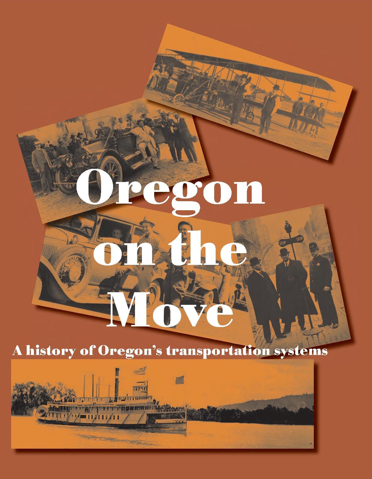
Oregon On the Move: A History of Oregon's Transportation Systems

The ODOT History Committee published this chronological listing of major developments in the agency's history in 2009.

************

History of State Highways in Oregon

This electronic-only document is produced by the ODOT Right-of-Way Unit, and was last updated in January, 2017.  It is a guide to the source materials for the background and history of individual state highways, including information from the right-of-way files, agreements and resolutions, Commission minutes, History Center files, and other resources. The document also offers electronic maps, including digitized versions of the county Market Road maps, and the Biennial Report maps.​


                                                              ************

The Interstate Highway System in Oregon​

Published in 2004, this document offers an historic overview of Oregon's interstate​ highway system.  It was prepared by historian George Kramer for the Oregon Department of Transportation.


                                                           ************

Agency Newsletters

This collection includes the Via and Transcript newsletters published 1976-2003.  Digitization was done by Internet Archives as part of a pooled fund study.

***********

State Highway Maps

The State Library of Oregon has made the collection of Oregon State Highway Maps digitized by the ODOT GIS Unit available to the public.  Maps span from 1919-2003. 

************

​Podcasts 

The Oregon Department of Transportation's Geo-Environmental Section has produced podcasts​ to share knowledge about Oregon's rich history and diverse environment.​

Bridges and Ferries

Oregon's Historic Bridge Field Guide.

Produced in 2013 by members of ODOT's Bridge Preservation and Cultural Resources teams, this publication updates an earlier document produced by the agency in the 1980s: Historic Highway Bridges of Oregon. 


"Spanning Oregon's Coast"

This Bridge Unit brochure shows the major bridges along Highway 101, many of which were designed by Conde McCullough, Oregon's master bridge builder.


Map Showing Location of Automobile Ferries in the State of Oregon: March 1, 1935

The five major coastal bridges forming the last links in the Oregon Coast Highway were dedicated in 1936.  This 1935 map was created as the bridges were being constructed, and the state offered free ferry service across these expanses until the bridges opened to automobile traffic.

Contact

Laura Wilt
Librarian
Telephone 971-701-0709 (Cell)
Email ODOT Library

Toothrock Viaductwp.jpg

Horse teams, Toothrock Viaduct
Columbia River Highway, 1915