 South Slough Reserve’s unique protected status makes the surrounding area a living laboratory. The Reserve’s wetlands, waterways, and forested areas offer ample opportunity for research that helps contribute to understanding of natural processes and survey the impacts of climate change, land use, and invasive species.
Scientists, graduate students, and community members monitor ecological change at the Reserve and the surrounding Coos Bay area. Measurements are used as points of reference to understand other coastal areas. This work informs stewardship and education at the Reserve and coastal management decisions across the world.
Areas of Research
Monitoring sites throughout the Reserve and Coos Bay allow researchers to track changes to environmental conditions over time. The Reserve is a System-Wide Monitoring Program (SWMP) site, part of a nationally coordinated effort between all research reserves to track estuarine conditions. There are 12
monitoring sites throughout the Reserve and Coos Bay.
-
Water quality. System-Wide Monitoring Program (SWMP) water quality stations monitor water temperature, salinity, dissolved oxygen, pH, turbidity, and water depth. Map of water quality stations.
-
Weather. The Reserve’s SWMP weather station measures air temperature, relative humidity, barometric pressure, wind direction and speed, precipitation, and solar radiation. A NOAA Climate Reference Network station measures air temperature and precipitation along with relative humidity, wind speed, solar radiation, infrared surface temperature.
- Climate Change. A National Oceanic and Atmospheric Agency (NOAA)’s
Climate Reference Network station monitors climate trends and supports climate-related research by
measuring air temperature, precipitation, relative humidity, wind speed, solar radiation, infrared surface temperature, and soil conditions (temperature, moisture).
Latest measurements.
The Reserve is part of a national program to understand how climate change affects coastal habitats by monitoring vegetation change, sediment and ground water dynamics, changes to sea level, and other environmental impacts including interacting stressors such as temperature, dissolved oxygen, or salinity.
Site Map.pdf and Monitoring plan.
Research informs stewardship actions to protect and maintain the Reserve. This type of work includes freshwater and tidal marsh restoration, restoring plants with cultural significance to local tribes, and restoring/enhancing native habitats and species, like eelgrass, Olympia oysters, Sitka spruce swamps, and the Western lily.
-
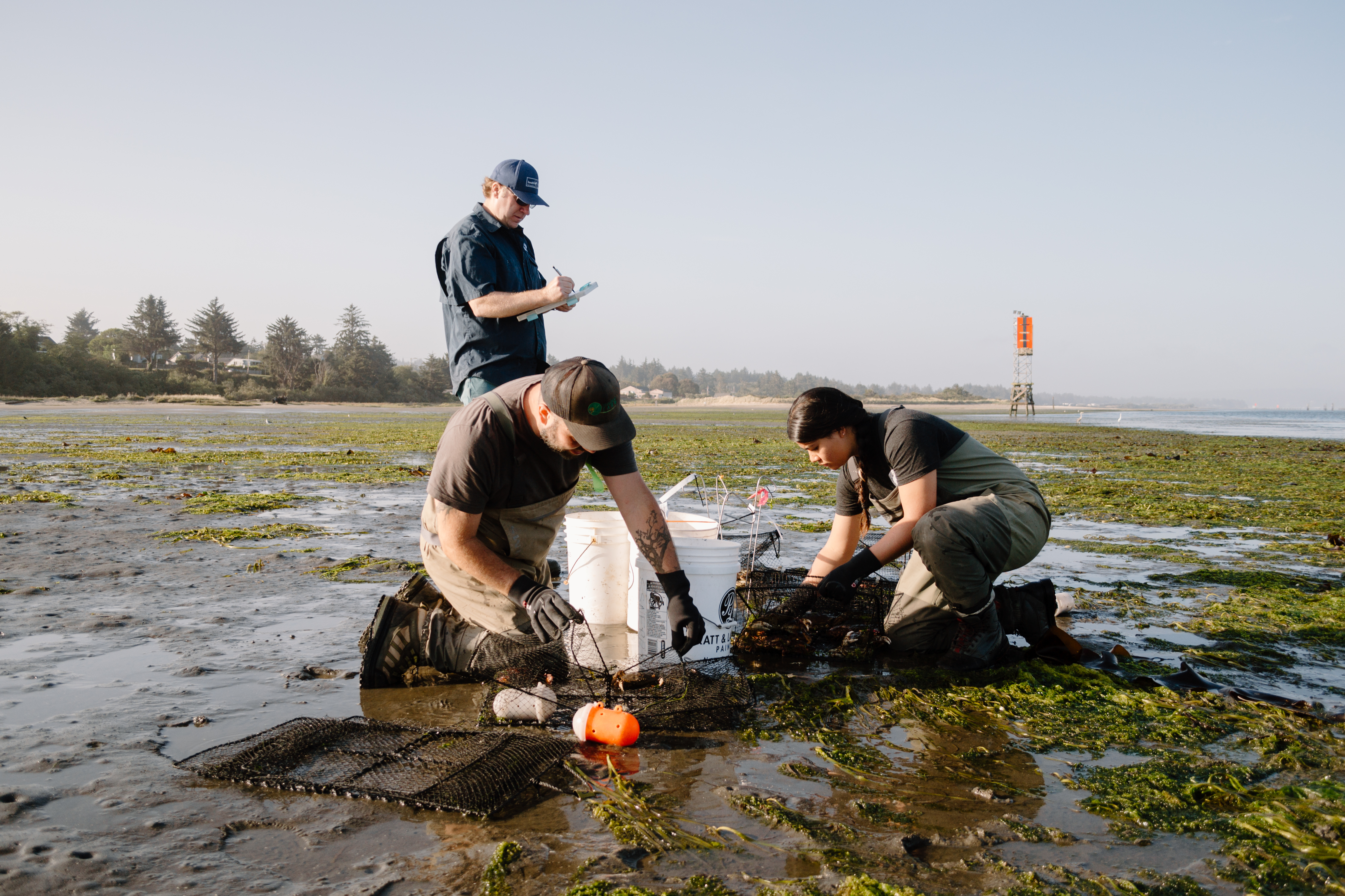
Observing Changes in Fish Habitat Use. By monitoring changes in population density and habitat use of fish and shellfish, like salmon, lamprey, eulachon, and Dungeness crab, researchers can begin to understand system changes, environmental stressors, and opportunities for habitat restoration. Project partners include Oregon State University and the US Forest Service.
-
Tracking Invasive Crab Species. Researchers are monitoring crab populations and behaviors around the Reserve, with a special interest in the predatory behavior and impacts of invasive species on habitats. The Reserve has studied the distribution and recruitment patterns of European green crabs in the Coos estuary since 2002. Find latest monitoring report here. The Reserve has also assessed lined shore crab populations and advancement during warm ocean events.
-
Olympia Oyster Restoration. Native oysters, Ostrea lurida, experienced a local extinction from the Coos estuary before the 20th century. They have since returned, but there is limited data on their population dynamics. The Reserve has partnered with California’s Elkhorn Slough on monitoring, modeling, and experiments to restore Olympia oysters.
-
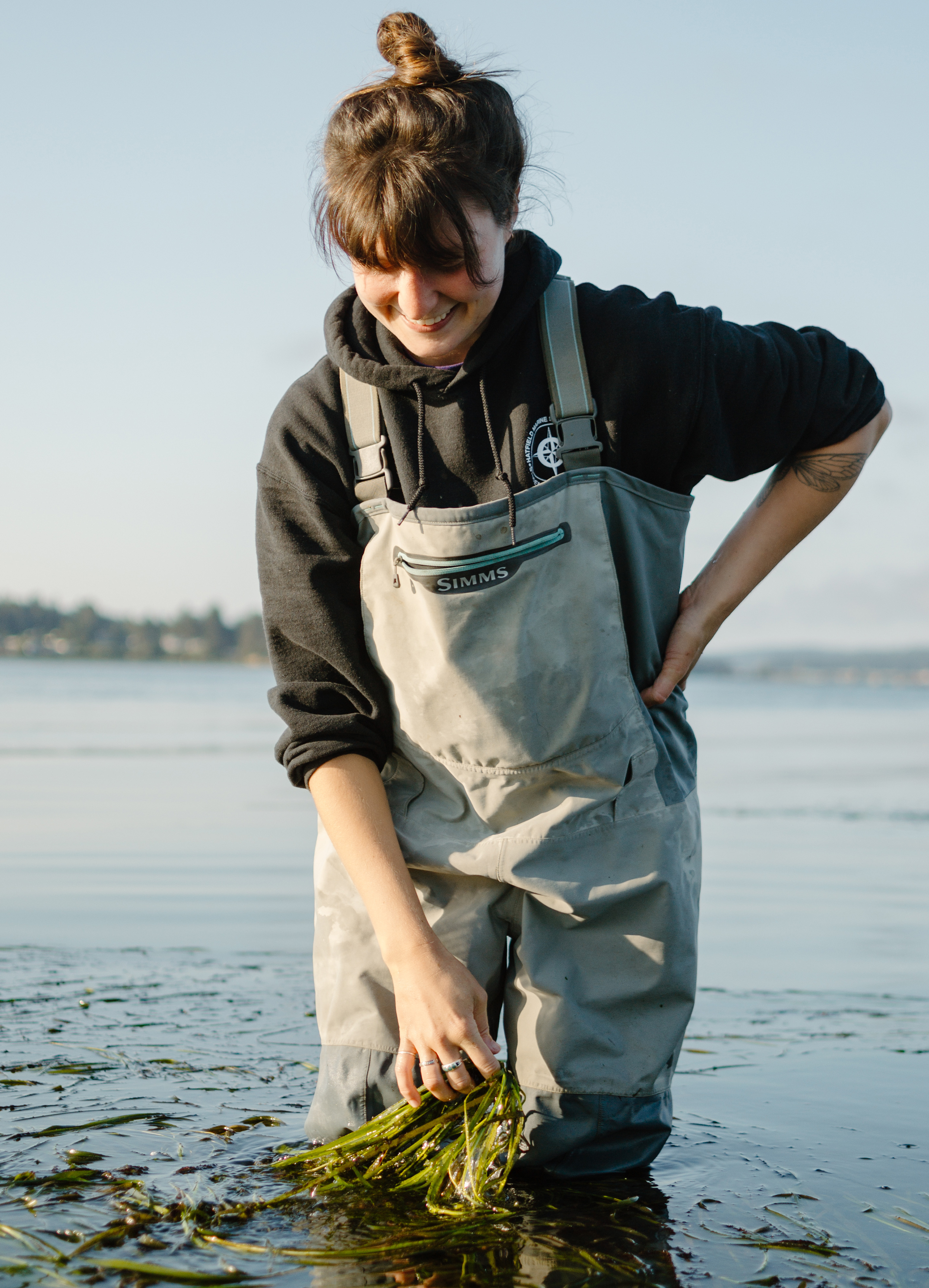
Eelgrass Restoration and Mapping. Eelgrass meadows at South Slough Reserve have declined since 2016. The Reserve is investigating causes of the decline, experimenting with restoration methods, and testing the use of unmanned aerial vehicles (UAVs) to map eelgrass in the estuary. Monitoring data is reported to SeagrassNet, a global seagrass monitoring program.
-
Habitat Mapping. The Reserve has created habitat maps that classify all wetland, aquatic, and forested habitats, as well as areas with cultural resources. Maps help to identify and describe changes to habitat as a result of factors like climate change, land use, and changes to the tide.
The Reserve’s research program has climate change monitoring goals to increase understanding of local effects of sea level rise, understand how climate stressors will affect air and water quality and priority habitats, monitor climate change and ecosystem function relationships, and advance communication about climate change impacts to diverse audiences.
- Carbon Sequestration. The Reserve is working with other researchers across the Pacific Northwest to study the capacity for different types of coastal ecosystems, like restored marshes, to store carbon and reduce the impact of greenhouse gasses.
- Ocean Acidification. Researchers are monitoring levels of acidity, as well as investigating the role of eelgrass habitats in reducing ocean acidification and stress created by hypoxia, lowered oxygen levels in the water.
- Understanding Algal Blooms. Several projects are working to understand factors that contribute the development of harmful algal blooms and the impact of these blooms on shellfish food supply.
Research informs stewardship actions to protect and maintain the Reserve. This type of work includes experiments to reintroduce native species, like eelgrass or plants with cultural significance to local tribes.
Learn more.
Researching at the Reserve
There are many ways to participate in research at South Slough Reserve—join us as a visiting scholar, participate in a fellowship or internship, volunteer to collect data as a community member, partner with us, or simply do a project at the Reserve. Here are a few resources to get you started:
Partnerships
 The Reserve collaborates with partners, including municipalities, Tribes, landowners, and research institutions on projects that contribute to understanding of estuaries and coastal areas. If you are interested in partnering with the Reserve for research you can contact Shon Schooler.
- The
Partnership for Coastal Watersheds, features a compilation of data that describes socioeconomic and environmental conditions in the Coos Bay area.
-
The Coos Estuary Shoreland Use and Zoning Analysis, a land planning tool for the Coos Bay that integrates resource protection with other land use considerations.
-
The Coos Estuary Hydrodynamic Model. The Reserve is supporting researchers with the Partnership for Coastal Watersheds to develop a computer model that simulates the motion of water in Coos Bay. The model is providing information about the salinity and movement of water through the Bay.