 What is a water budget?
A water budget accounts for the balance of water flowing into and out of an area over a specific time period:
inflows – outflows = change in storage
Water budgets are sometimes compared to bank accounts, with inflows and outflows analogous to deposits and withdrawals, and changes in water storage similar to the account balance. However, the natural environment is far more complex than a single account; a closer comparison might be balancing the books of a large company with multiple divisions, each with regular fluctuating and varied income streams and expenditures. Understanding the company's overall financial position means accounting for each division as well as the transfers between them.
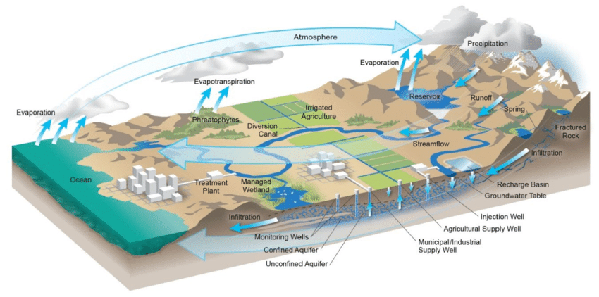
Similarly, a comprehensive water budget for a hydrologic basin must account for all water entering and leaving the system, as well as flow between systems within the basin. This includes the atmosphere, surface water, and groundwater. The various components and flow pathways vary locally depending on the climate, topography, land cover, hydrogeology, water use, and the human footprint - and some of these components are difficult to measure. With Oregon's complex and varied hydrogeologic conditions, the components that make up this accounting will vary depending on the area studied. Developing meaningful water budgets requires a good understanding of local conditions and extensive data collection, analysis and modeling.
Why water budget information is important to Oregonians
Scientists, water managers and Oregon’s varied water users look for the best information available as they balance water needs with the water that’s available. As this information is complex and varies based on local conditions, improving estimates of both supply and use is a priority to support informed decision-making.
With the support of legislative investments, the Oregon Water Resources Department (OWRD) has launched multiple scientific investigations to better estimate some of these harder to measure components – baseflow, groundwater recharge, surface water information, and the water lost from evapotranspiration, to name just a few. Once complete, these investments will result in stronger groundwater estimates and more effective tools to evaluate consumptive use.
This work is still in early stages, with new information and tools coming online through 2030. This page will be updated twice a year with any new information, including project updates and links to existing data. For those with less background in water science, this page also provides educational resources to build foundational knowledge and to better understand the water budget information becoming available.
Photo credit: CA Department of Water Resources
OWRD is working to improve estimates of both surface and groundwater supplies across Oregon.
In 2021 (through HB 2018) the Oregon legislature directed OWRD to partner with the U.S. Geological Survey (USGS) on a Statewide Recharge Study to provide groundwater recharge estimates statewide. OWRD and USGS are working closely together to develop technical tools and data that will inform groundwater budget information across the state. These formative investigations are currently scheduled for completion in 2028.
OWRD is also developing the Surface Water Information Modeling System (SWIMS) as a modern update to the Water Availability Reporting System (WARS). This system is used to calculate water availability for Oregon watersheds and make that information available to support responsible allocation of surface waters. Information from this new system is expected to be available by January 2030.
OWRD engages in ongoing data collection through stream gaging stations, observation wells, and other sampling and water measurements. This existing information will be paired alongside the modeling and study results described above to provide the best available information to the public and water managers about an area's water supply.
Information about these investigations and OWRD's ongoing data collection are below. New tools and information will be shared here as it becomes available.
Studies and Research Initiatives:
Statewide Recharge Study
Statewide Recharge Study Bi-annual Update - This handout provides updates about this study, including improving baseflow estimates, and developing conceptual groundwater budgets.
Baseflow Estimates - This six-page fact sheet provides a high level summary of USGS' base flow data release included in the handout above.
Surface Water Information Modeling System (SWIMS) development:
Surface Water Information Modeling System (SWIMS)
Ongoing Data Collection
Groundwater Information Systems (GWIS) Mapping tool
Stream Gage Data
.jpg)
Photo: Gaging station at Cottonwood Reservoir, Lake County, OR
Photo credit: Garrett Steensland
OWRD's Surface Water Team and its partners are developing datasets and tools to better understand consumptive water use. The Statewide Evapotranspiration (ET) Project, a collaborative effort with the Desert Research Institute and OpenET, developed consumptive use and groundwater pumpage estimates for all irrigated fields and evaporation estimates for major reservoirs and lakes in Oregon. This information is key to developing water budgets, and now supports other work across the agency, including groundwater basin studies, local planning efforts, and the development of surface water estimates (see SWIMS below).
OWRD is also working with partners to utilize today's best technology to optimize the water available for consumptive uses. Ongoing collaboration with the U.S. Bureau of Reclamation's AgriMet program and Oregon State University Extension has led to an expansion of Oregon's AgriMet weather station network. Research, education and outreach about how to use these stations supports irrigators, water managers, and planners as they make decisions with the aid of crop-specific models using real-time weather data.
This information, along with OWRD's ongoing data collection efforts, is building a growing body of knowledge about the water use side of a water budget. Updates and newly available tools will be shared here as they become available.
Studies and Research Initiatives
Statewide Evapotranspiration (ET) Project:
Water Use_Bi-annual Update_January 2026 - This handout provides emerging water use tools and information updates, including statewide ET estimates, and the expanding data available for irrigators and water managers.
Crop Evapotranspiration, Consumptive Use, and Open Water Evaporation for Oregon - This Desert Research Institute report details study results quantifying ET from all major water bodies and irrigated fields in Oregon.
OpenET (Evapotranspiration mapping tool)
Ongoing Data Collection:
Water Rights Information System (WRIS)
Water Use Reporting
AgriMet program (real-time weather data specific to irrigated fields)
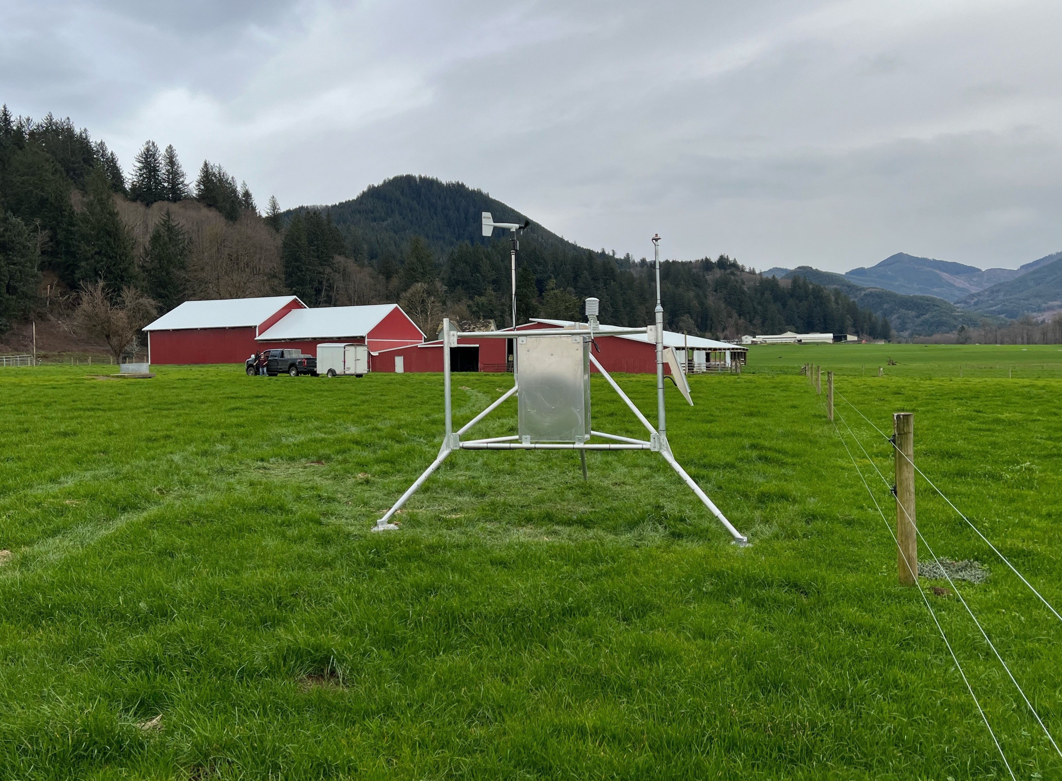
Photo: AgriMet station in Tillamook, OR
Some of OWRD’s studies focus on a particular region or water system in the state. These studies inform planning, developing and implementing policies, managing water use, and partnerships that can emerge from a shared understanding of a region’s water situation. The resources below share current regional scientific information that is available or being actively developed, and links to local water planning information and activities.
Links to Planning Activities:
The studies listed below are underway, recently completed, or a source for current engagement in a region. For a more comprehensive list of available information about a specific area please see Administrative Basins.
Sign up for the email communications you'd like to receive from OWRD:
For questions or to provide feedback about this webpage, please email Sue Parrish, OWRD Community Engagement Coordinator.