About
This project is part of our strategy to improve accessibility by correcting non-ADA compliant curb ramps and signalized intersections on state highway segments in the communities of Redmond and Prineville.
In Redmond, the project will improve ramps at the following locations:
- OR126 (McKenzie Highway) from the signalized intersection of southwest Highland Avenue at Southwest 27th street to the signalized intersection of southwest Glacier Avenue at U.S. 97.
- U.S. 97 from southwest Evergreen Avenue to southwest Highland Avenue
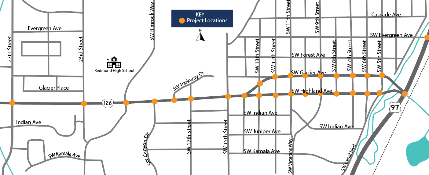
Map 1 of Redmond project locations
- U.S. 97 at North Canal Boulevard Interchange (Exit 119) from the signalized intersection of North Canal Boulevard at Northeast King Way to the intersection of Northwest 6th Street at Northwest Quince Avenue.
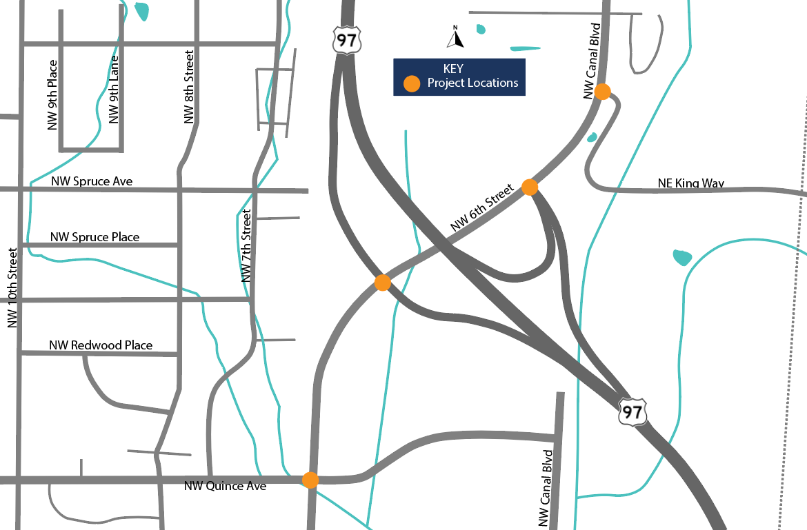
Map 2 of Redmond project locations
In Prineville, the project will improve ramps at the following locations:
- U.S. 26 (Ochoco Highway) from the intersection of Northeast 3rd Street (U.S. 26) to the intersection of East 3rd Street (U.S. 26) at Northeast Stearns Drive.
- OR 380 (Paulina Highway) from the intersection of Northeast Combs Flat Road at Northeast Mason Drive to the intersection of Northeast Combs Flat Road at Southeast 2nd Street.
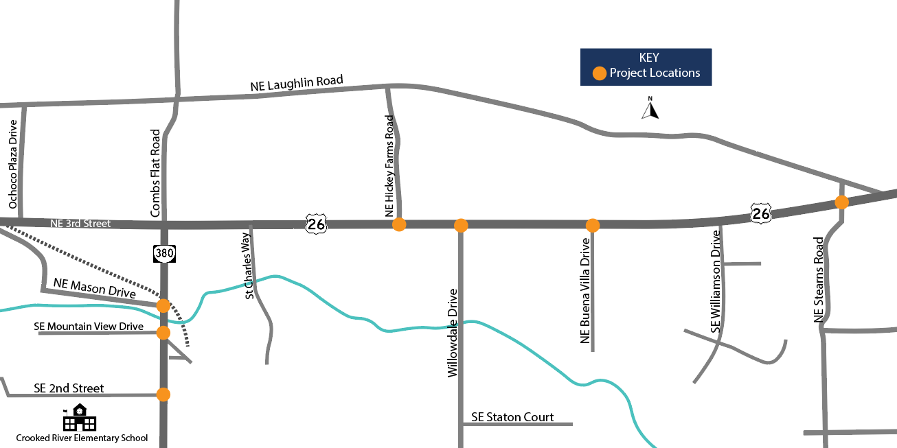
Map of Prineville project locations
Location
MultipleCost and Funding
$12,361,000.00
Contractor
Cascade Civil Corp