
Oregon State Flag An official website of the State of Oregon »

Project-Details


OR 39 South Sixth Street Facility Plan

Planning Phase

Region 4: Central Oregon (Klamath Falls, Klamath)


​​​​Develop a long-​term facility plan for the OR 39 / South Sixth Street Corridor.​


Impacts

Meetings and Events

​Join us for an Open House

When: February 26th - drop in anytime between 5:00 p.m. - 7:30p.m.

Where: Klamath County Fair Grounds- Exhibit Hall #2 (blue building) 

3531 S 6th Street, Klamath Falls OR 97603​

Details

About

This is a long-range planning project by the Oregon Department of Transportation in collaboration with Klamath County. The plan will address safety and operational deficiencies on OR 39, South Sixth Street, from the Klamath Falls City Limits to the OR 39/ OR 140 intersection in order to create a safe, organized, and modern corridor that provides adequate access for the community and acts as a commercial corridor for the county.  
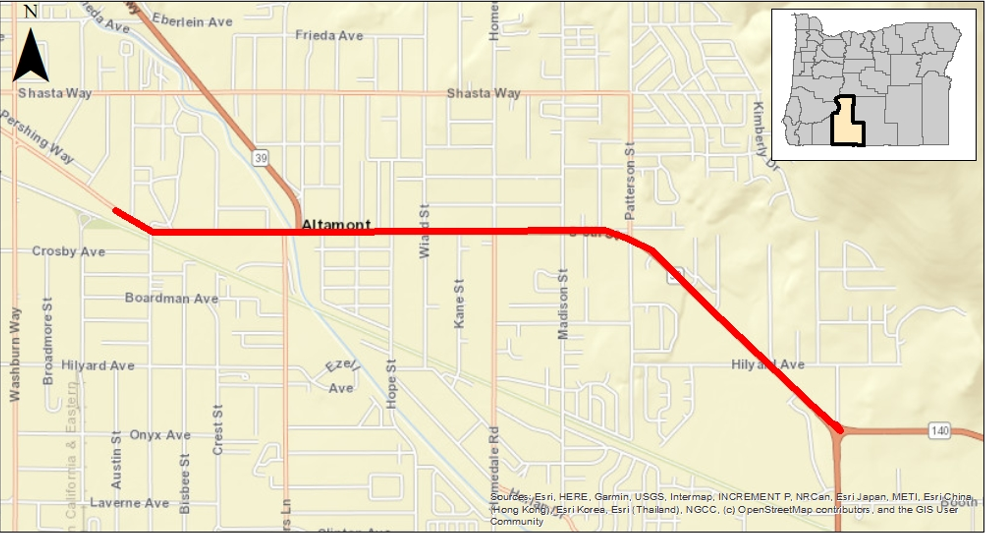
Location

OR 39 |

​OR 39 from the Klamath Falls City limits (Arthur) to the OR 140 intersection.

Map of project area

Cost and Funding

​ODOT state planning and research funding: $250,000​

Contacts & Media

Project map

Project Contact

Transportation Planner
Ken Shonkwiler
Email
kenneth.d.shonkwiler@odot.oregon.gov
Phone
541-815-6877

Last Updated

2/6/2026 1:50 PM

Project Number

OR39_South6thSt_Facility

Project Documents

Related documents to this project
Final_TM3.2_Land_Use_and Transportation_Systems_Inventory.pdfFinal TM3.2-Land Use and Transportation Systems Inventory
DRAFTTM5-Concept_Development.pdfTM#5 – Concept Development