 The Department of State Lands and other Oregon state agencies own and manage lands, including the beds and banks of certain waterways across the state. This page contains maps and inventories of those lands.
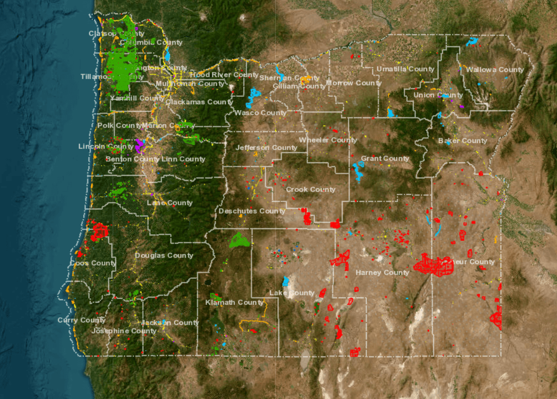
State-Owned Lands
Multiple state agencies own land around Oregon, including the Department of State Lands, the Department of Forestry, and the Department of Fish and Wildlife. DSL maintains a map and inventories of the ownership of these lands.
The map is a reference tool that helps identify where
most state-owned lands are located. The lands shown are those that have been assigned a tax lot by a county assessor's office. Boundaries are not precise and some state-owned properties may be missing. Each state agency manages and leases their own land and many large land-owning agencies also sell their land. Contact the state agency owner of an individual parcel for more information.
To request the map data, contact DSL's ownership specialist.
Inventories of Properties Owned by State Agencies
Oregon-Owned Waterways
The Department of State Lands owns the beds and banks of navigable waters, including Oregon's tidally-influenced waters and territorial sea, and certain rivers and lakes.