Geologic Mapping
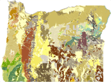
DOGAMI's core function is to map and to organize descriptions of Oregon’s geology, landforms, and geoprocesses to assess resources and natural hazards, to support healthy ecosystems, and to guide safe and prudent rural and urban development.
DOGAMI conducts geologic mapping, creates and maintains
digital geologic databases, and collects high-resolution aerial
lidar to characterize the state’s geology and to enhance understanding of the state’s geologic resources and
hazards. Geologic maps provide important information pertaining to geologic hazards and the distribution, sustainability, and conservation needs of the state’s mineral, energy, and water resources. Targeted new mapping updates the geologic framework of the state and places an emphasis on digital map products and derivatives that are accessible and usable by the public.
Mineral Resources
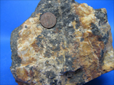
As part of the geologic mapping program, geologists also map precious and industrial metals, geothermal and water resources, and hazardous minerals.
DOGAMI's
Mineral Land Regulation & Reclamation regulatory program (MLRR) administers effective and balanced regulation of mineral, oil and gas, and geothermal energy development to support the environment, economy, and people of Oregon.
STATEMAP
 Funding from the STATEMAP portion of theNational Cooperative Geologic Mapping Program (NCGMP) has been at the core of DOGAMI's geologic-mapping program since 1993. STATEMAP is the primary source of funds for the production of geologic maps in the United States. DOGAMI receives STATEMAP funds through an annual competitive grant process. As of 2018, DOGAMI has received STATEMAP funding for 25 consecutive years, with funding awards annually ranking as one of the top 10 states in the Nation.
The primary objective of the STATEMAP component of the NCGMP is to establish the geologic framework of areas that are vital to the welfare of individual States. Each State Geologist determines the State's mapping priorities in consultation with a State Mapping Advisory Committee. The program has allowed DOGAMI to significantly increase the production of new maps and has, through the State Geologic Mapping Advisory Committee, helped focus mapping on areas where resource and natural hazard issues require good geologic data.
OGMAC
The Oregon Geologic Mapping Advisory Committee (OGMAC), in consultation with the State Geologist helps prioritize geologic mapping in the state of Oregon. These priorities are based on multiple criteria where geologic mapping is required to solve critical resource or natural hazard issues. OGMAC meets annually and is made up of professional geoscientists and natural resource specialists representing federal, state, and local government agencies, academia, and private industry who have a vested interest in Oregon's geologic framework, hazards, and resources.
Geologic mapping information is used to address many important statewide issues, including:
- Conservation and sustainability of water resources
- Identifying and reducing losses from tsunamis, landslides, flooding, earthquakes, and volcanoes.
- Land use evaluation and planning (e.g. aggregate mining vs. agriculture).
- Design and construction of infrastructure requirements such as utility lifelines, transportation corridors, and surface water impoundments.
- Siting of critical facilities (e.g., power transmission lines, wind farm developments).
- Conservation and sustainability of agriculture and timber resources.
- Mitigating effects of coastal and stream erosion.
- Exploration for, and development of, metallic mineral, aggregate, and energy resources.
- Correlation between geology and fire-fuel loads.
- Direct geoscientific research to improve understanding of Earth history and processes
Projects
DOGAMI's STATEMAP projects annually focus on specific areas across the state where up-to-date geologic data is needed. Projects begin several years of detailed mapping at the 1:24,000-scale to understand the area's geology. This work is then summarized in subsequent synthesis compilation works to provide the kind of regional coverage that users need. DOGAMI has focused previous STATEMAP projects on core population areas surrounding La Grande, Prineville, Medford, Hood River, the southern Willamette Valley, and the southern Oregon Coast. Current projects are focused in the vicinity of The Dalles, Dufur, and Biggs in the Columbia River Gorge of north-central Oregon and near Burns in southeast Oregon.
Dogami geologists conduct the geologic mapping and frequently work closely with EDMAP students and their professors, as well as with FEDMAP geologists who may be mapping within the State. Such cooperative mapping strategies with the USGS and academia, allows DOGAMI to produce high-quality, multi-use geologic products in a very cost-effective way.
These fact sheets provide year-by-year mapping progress.
FY2016 (PDF)
FY2015 (PDF)
2014 (PDF)
2013 (PDF)
2012 (PDF)
2011 (PDF)
2010 (PDF)
2009 (PDF)
2008 (PDF)
Long Range Geologic Mapping Plan for Oregon
EDMAP
EDMAP is the component of the NCGMP that trains the next generation of geologic mappers. The NCGMP allocates funds to colleges and universities in the United States and Puerto Rico through an annual competitive grant process.