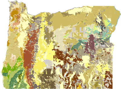
From columnar basalts along the Columbia River to the sandstone of the southern Oregon Coast to Eastern Oregon's Painted Hills, Oregon's geology is amazing. Explore the map to see the incredible variety of rock types that make up our state.
Go to the interactive map.
Tips & tools for using the map
Map Legend
Learn more about Oregon's geologic history at the
Oregon: A Geologic History website.
Get the geodatabase
The interactive map displays just a part of the data available in
Oregon Geologic Data Compilation release 6 (OGDC-6). OGDC-6 brings together the best available geologic map information for the entire state by integrating the work of many individual geologic mappers. 346 source maps are referenced in the current version of OGDC. If you want to explore further, download the
OGDC-6 geodatabase. Note: This geodatabase requires specialty software to use.
OGDC-7 geodatabase (GeMS schema) and OGDC-8 geodatabase also available.