Landowners planning projects in wetlands or waterways need to work with the Department of State Lands to avoid, minimize, or compensate for impacts to these natural resources – a concept known as mitigation. In Oregon, the goal of mitigation is to work toward a zero net loss of wetlands or waters while protecting the long-term environmental and social benefits of these natural resources.
Mitigation is involved in all steps of the
removal-fill permitting process.
- DSL provides maps, inventories, and technical assistance to help identify the location of wetlands and waters and avoid project impacts.
- Department staff work with permit applicants to explore alternative site designs and locations to avoid or minimize impacts.
- When permanent impacts are unavoidable, applicants work with DSL to compensate for resource losses by supporting or creating projects that improve wetlands or waters.
Compensating for Permanent Impacts
Projects likely to permanently impact or remove wetlands or waters require compensatory mitigation to compensate for the loss of societal and environmental benefits. There are several different types of compensatory mitigation that may be available. Work with the
DSL aquatic resource coordinator for your county to identify which option is best for your project and the impacted resources.
To learn more about compensatory mitigation, read chapters eight through ten of the
DSL removal-fill guide.
Compensatory mitigation options may include:
Also known as “permittee-responsible mitigation.” Applicants can improve wetlands or waters on the same site where project impacts will occur or another site in the same area that has received Department approval. DSL recommends working with an environmental consultant who has experience in aquatic habitat improvement projects.
Applicants can also offset their impacts by purchasing credits, the funds from which go toward mitigation banks or in lieu fee projects that are restoring or enhancing wetlands or waters. The credits need to be purchased from a bank or in lieu fee project that serves the same area where the impact is occurring. Bank and in-lieu fee service areas are usually determined by watershed boundaries.
To purchase credits from a mitigation bank or in lieu fee project:1. Check the DSL
mitigation banks map to see if there are banks or in lieu fee projects that serve the location your project is impacting.
2. Determine if the type of wetlands or waters that will be impacted at your project site match the type listed in the bank details on the map.
When there are no credits available to purchase for mitigation banks or in-lieu projects in your watershed, you may be able to mitigate for the impacts of a project by making a payment to the Oregon Removal-Fill Mitigation Fund in lieu of completing your own mitigation project. The mitigation fund is used to pay for projects that improve wetlands and waters.
Please note that the U.S. Army Corps of Engineers does not recognize this option; therefore, payment in lieu of mitigation is only available for cases in which the state requires mitigation but the U.S. Army Corps does not.
Forms that may be needed:Payment calculator for in-lieu fee mitigation
Mitigation Funding Opportunities
Grants may be available for projects that that create, restore, or improve wetlands or waters.
Establishing a Mitigation Bank
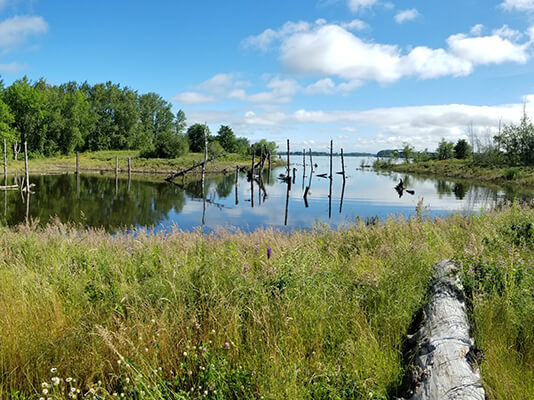
Across Oregon, there are wetlands and waters that have been impacted by past activities. Many of these resources no longer exist or do not provide their full environmental and societal benefits because they were drained or repurposed years ago.
If you have a former or impacted wetland, stream, or naturally occurring body of water on your property, you may be able to earn money by restoring that site. A mitigation bank is a large-scale wetland or stream restoration project. By restoring a site and adding wetlands or waters to Oregon, you create mitigation bank credits. Landowners with projects in wetlands or waters can purchase credits from you to offset their impacts.
Learn more about how to establish a mitigation bank.