The state of Oregon has an extensive shoreline bordering the ocean, estuaries, and coastal lakes. Oregon communities near and far from the coast benefit in many ways from the availability of public access to nature and waters, including intrinsic benefits, economic benefits, improved health outcomes, and an increased stewardship ethic for the coast. Public access to coastal shorelines is an important economic driver for local communities and should be carefully managed to balance recreation and tourism needs with the protection of coastal habitats. > Oregonians value public access to the shore. Accordingly, the state established the legal means and necessary improvements for the public to enjoy beaches and coastal waters. The public has free access to Oregon’s sandy beaches because of the
Beach Bill of 1967. In addition, Oregon’s Land Use Planning Program is an instrumental policy framework that protects coastal public access to beaches and coastal waters. Coastal public access themes are addressed in several of Oregon’s Land Use Planning Goals and associated rules, including Goal 5: Natural Resources, Scenic and Historic Areas, and Open Spaces,
Goal 8: Recreational Needs,
Goal 16: Estuarine Resources,
Goal 17: Coastal Shorelands, and
Goal 18: Beaches and Dunes. However, key policies addressing protection of coastal public access are embedded primarily in Goal 17.
The department is currently undergoing a
rulemaking process related to coastal public access.
Coastal Access Protections
There are two major pieces of public policy that provide and protect public access rights: the famous Oregon Beach Bill of 1967 and
Statewide Planning Goal 17: Coastal Shorelands.
Oregon Beach Bill
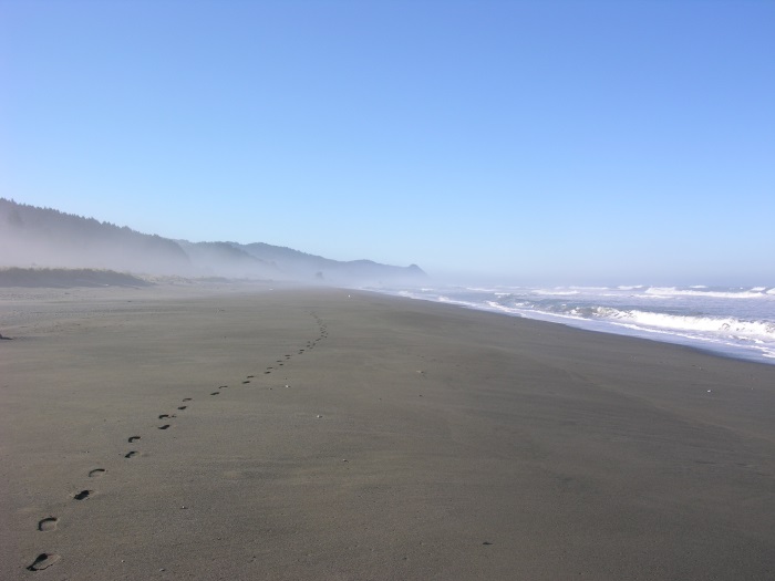
Oregonians have always enjoyed visiting the coast; a tradition that was officially protected in 1913 when Governor Oswald West and the Oregon legislature established the state's 362 miles of shoreline as a public highway. This designation only applied to the wet-sand portions of the beaches (Oregon Revised Statutes 390.605-755).
Then, in the summer of 1966, the owner of a Cannon Beach hotel put down large driftwood logs to block off a section of the beach to all but the hotel guests. In response, the State passed the Beach Bill in 1967. The Beach Bill established a permanent public easement for access and recreation along the ocean shore seaward of the existing line of vegetation, regardless of ownership. The Beach Bill also set forth a policy, under what is now the Oregon Parks and Recreation Department (ORPD), to provide public access to the beach at routine intervals.
Goal 17
Statewide Planning Goal 17: Coastal Shorelands outlines planning and management requirements for the lands bordering estuaries, coastal lakes, and the ocean shore. Provisions in Goal 17 focus on the protection and management of resources unique to shoreland areas, such as fish and wildlife habitat, water-dependent land uses, and potential estuary restoration or mitigation sites. The goal also contains a provision requiring the protection and improvement of public access to and along coastal waters by local governments.
Goal 17 requires that cities and counties, in coordination with OPRD, have plans to provide public access to the beach. The goal also requires local governments to protect those access sites and replace them if they are lost for any reason. Existing public ownerships, rights-of-way, and similar public easements in coastal shorelands that provide access to or along coastal waters must be retained or replaced if sold, exchanged, or transferred. Rights-of-way may be vacated to allow construction in shoreland areas, as long as public access across the site is maintained.
Coastal Public Access Guidance for Local Government Planners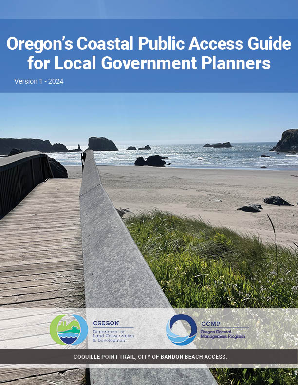
In 2024, DLCD published
Oregon's Coastal Public Access Guide for Local Government Planners.This guide was created to provide Oregon’s coastal governments with a framework for planning, maintaining, and improving a community's public access program, a requirement of Goal 17. Local government and tribal staff, especially land use planners, public works, and parks staff, can use this guide as a roadmap to make policy and on-the-ground improvements to a community's public access to coastal shorelines and waters.
This guide includes federal and state policy analysis, survey insights, planning guidance, strategies for meaningful tribal engagement, accessibility considerations, and mapping tools. The guide provides Model Coastal Shoreland Public Access Comprehensive Plan Policy Language also provided in a Word document to use as a template for comprehensive plan updates.
Oregon's Coastal Public Access Guide for Local Government Planners
Model Coastal Shoreland Public Access Comprehensive Plan Policy Language
Coastal Access Inventories
 Goal 17 requires local governments to maintain an inventory of coastal access locations. To assist with this requirement, the Oregon Coastal Management Program has funded an inventory of public access points every ten years since 1990. The inventory includes all developed and undeveloped sites that provide physical or visual access to the ocean coastline, estuaries, and coastal lakes. The data is intended to be incorporated into the Goal 17 inventories of local comprehensive plans.
The most recent
coastal access inventory is available online.