Get to Know the Region
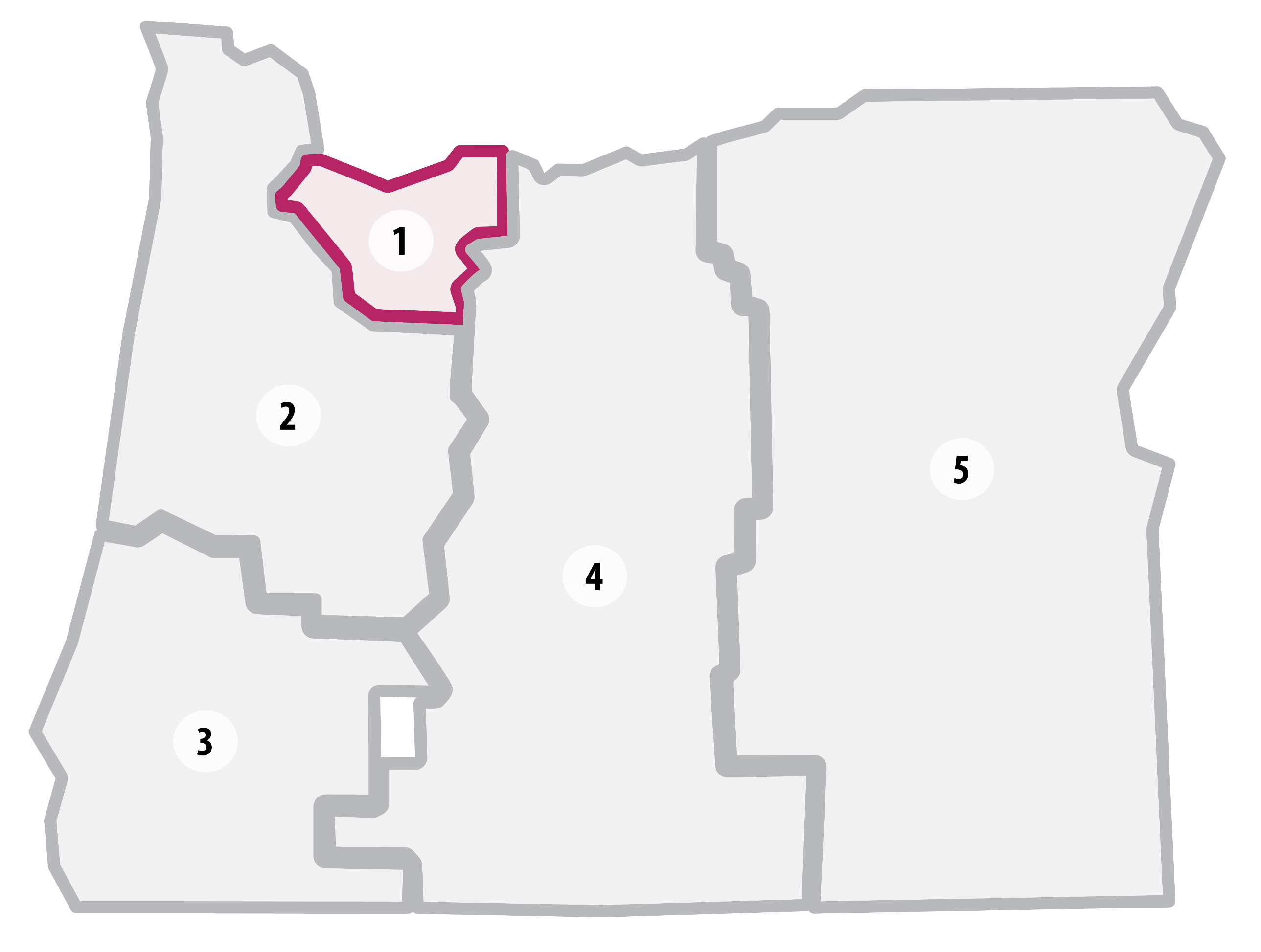 Region 1 builds, operates, and maintains the multimodal transportation system serving the Portland metropolitan area, Mount Hood, and the Columbia River Gorge National Scenic Area. Region 1 implements ODOT programs and facilitates multimodal solutions for the 2.2 million residents of Clackamas, Hood River, Multnomah, and Washington counties.
Region 1 is uniquely positioned at the intersection of Oregon’s busiest highway interchanges, freight corridors, and ports essential to the state’s commerce and is the gateway to many travelers visiting our state. Multiple stretches of Portland-area highways must accommodate over 100,000 vehicles a day. The unique challenges of the region include managing significant congestion on major highways, rapidly responding to incidents, and improving pedestrian safety for a growing urban region.
Our region also includes many rural communities with notable tourist attractions like Multnomah Falls in the Columbia River Gorge National Scenic Area and Timberline Lodge on Mt. Hood.
Key Stats
Lane Miles: 2,146
Bridges: 520
Highlighted Projects for 2027-2030
We've selected a few Region 1 projects as examples of the type of work you can expect from this STIP cycle.
OR 8 (Tualatin Valley Hwy): East Ln - SW 170th Ave


 OR 99E (SE McLoughlin Blvd): SE River Rd - W Arlington St
I-84: Moffett Creek Westbound Bridge
OR 99E (SE McLoughlin Blvd): SE River Rd - W Arlington St
I-84: Moffett Creek Westbound Bridge