DOGAMI OPEN-FILE REPORT SERIES
Publication Preview
Open-File Report O-25-02, Ecola State Park Landslide Risk Analysis, Clatsop County, Oregon, by William J. Burns, Laura L.S. Gabel, Robert W. Hairston-Porter, Jonathan C. Allan, Reed J. Burgette, Jon J. Franczyk, Lowell H. Anthony, Jason D. McClaughry, and Alan R. Niem; 49 p. report, six map plates, one Esri® geodatabase with internal metadata, external metadata in .xml format.
WHAT’S IN THIS REPORT?
This paper evaluates landslide hazard and risk at Ecola State Park, Clatsop County, Oregon. The intended audiences for this paper include those in government, industry, academia, and the public.
PUBLICATION DOWNLOADS
LOCATION MAP
Figure 1-1. Map of Clatsop County and the study area.
GEOGRAPHIC INFORMATION SYSTEM (GIS) DATA
Geodatabase is Esri® version 10.7 format.
Metadata is embedded in the geodatabases and is also provided as separate .xml formatted files.
Each dataset listed below has an associated, standalone .xml file containing metadata in the Federal Geographic Data Committee Content Standard for Digital Geospatial Metadata format.
O-25-02_EcolaLandslideRisk.gdb
|
|
Feature Classes: |
Deposits
| |
.xml
|
Scarp_Flanks
| Polygons
|
.xml
|
Scarps
| Polylines
|
.xml
|
Study Area
| Polygon
|
.xml
|
Contacts_and_faults
| Polylines
|
.xml
|
Landslide_Susceptibility_Risk
| Raster dataset
|
.xml
|
Lidar_Change_Landslide_Inventory_2009_to_20203
| Polygons
|
.xml
|
Map_Unit_Polygons
| Polygons
|
.xml
|
Orientation_Points
| Points
|
.xml
|
Orthophoto_Landslide_Inventory
| Polygons
|
.xml
|
MAP PLATES (PDF Format)
 Plate 1: Map of Ecola State Park Study Area, Oregon (157.2 MB PDF)
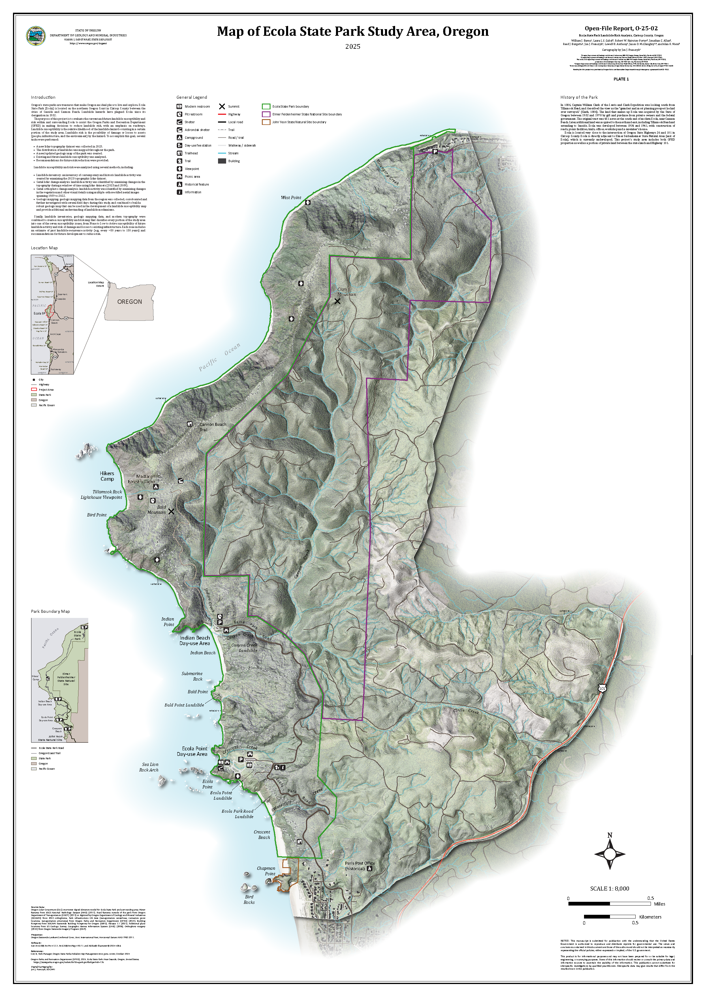
Plate 2: Geologic Map, Ecola State Park Study Area, Oregon (90.9 MB PDF)
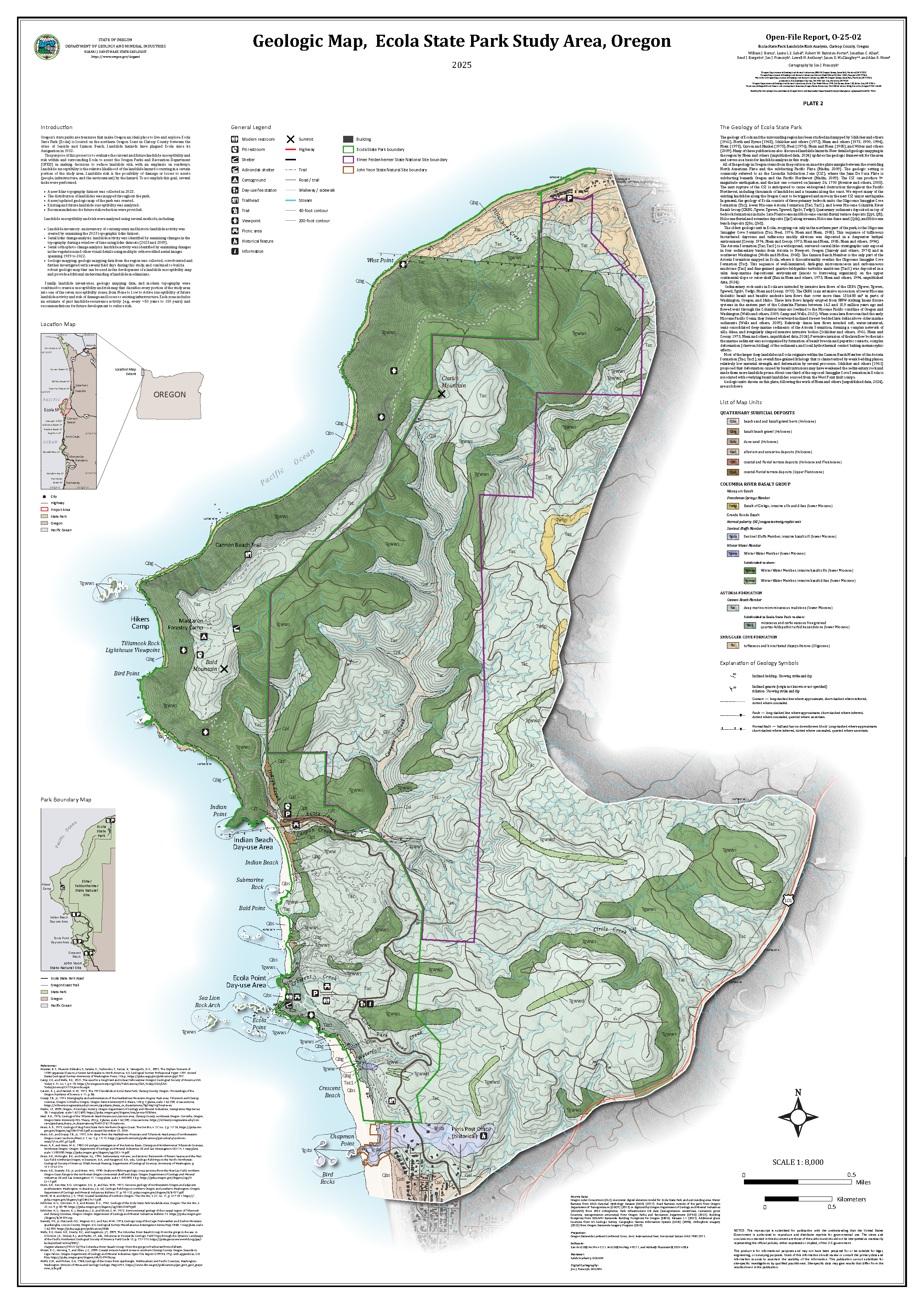
Plate 3: Lidar-Based Regional Landslide Inventory Map (SP-42), Ecola State Park Study Area, Oregon (87.5 MB PDF)
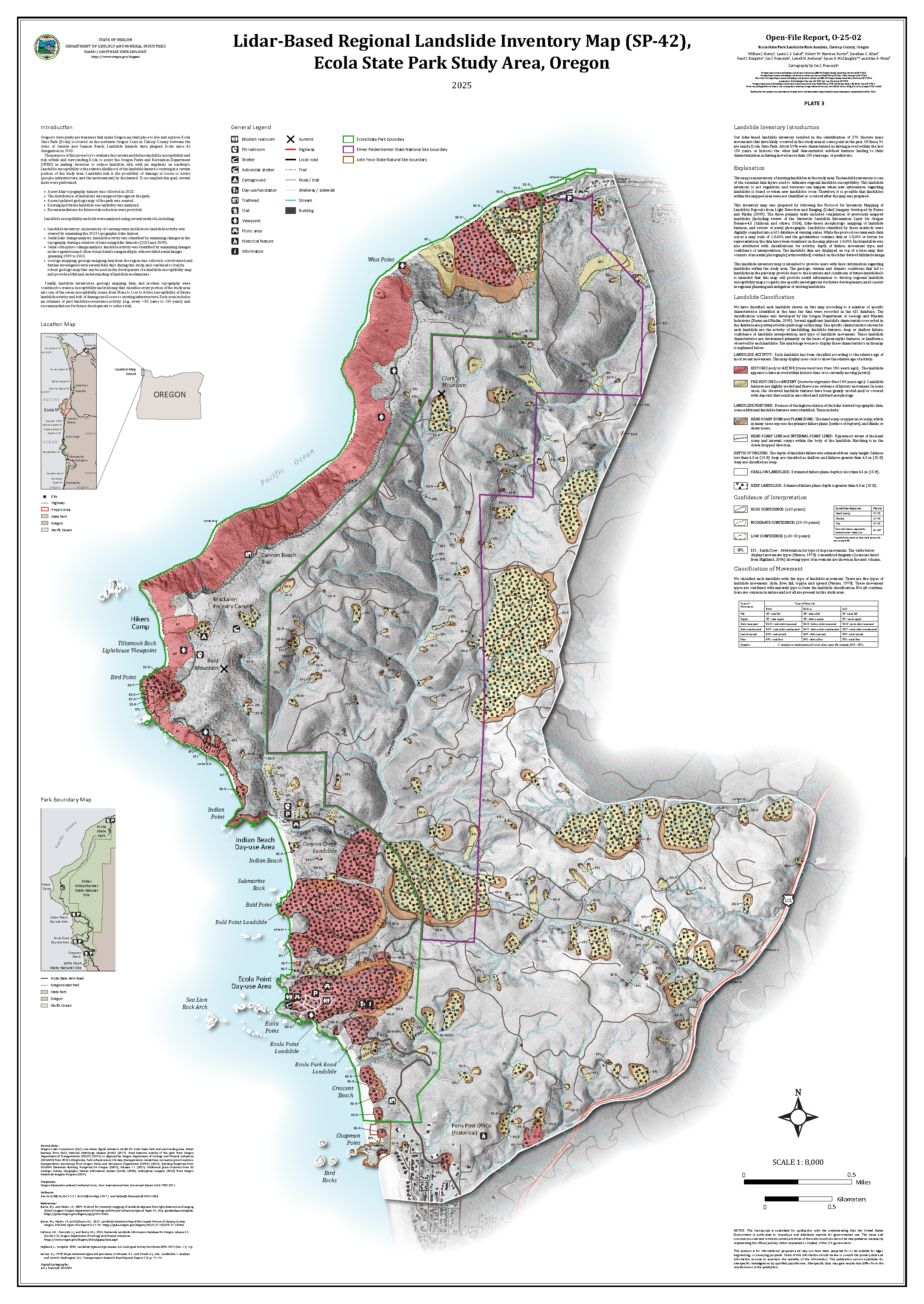
 Plate 4: Serial Orthophoto-Based Landslide Inventory Map (1939-2022), Ecola State Park Study Area, Oregon (86.3 MB PDF)
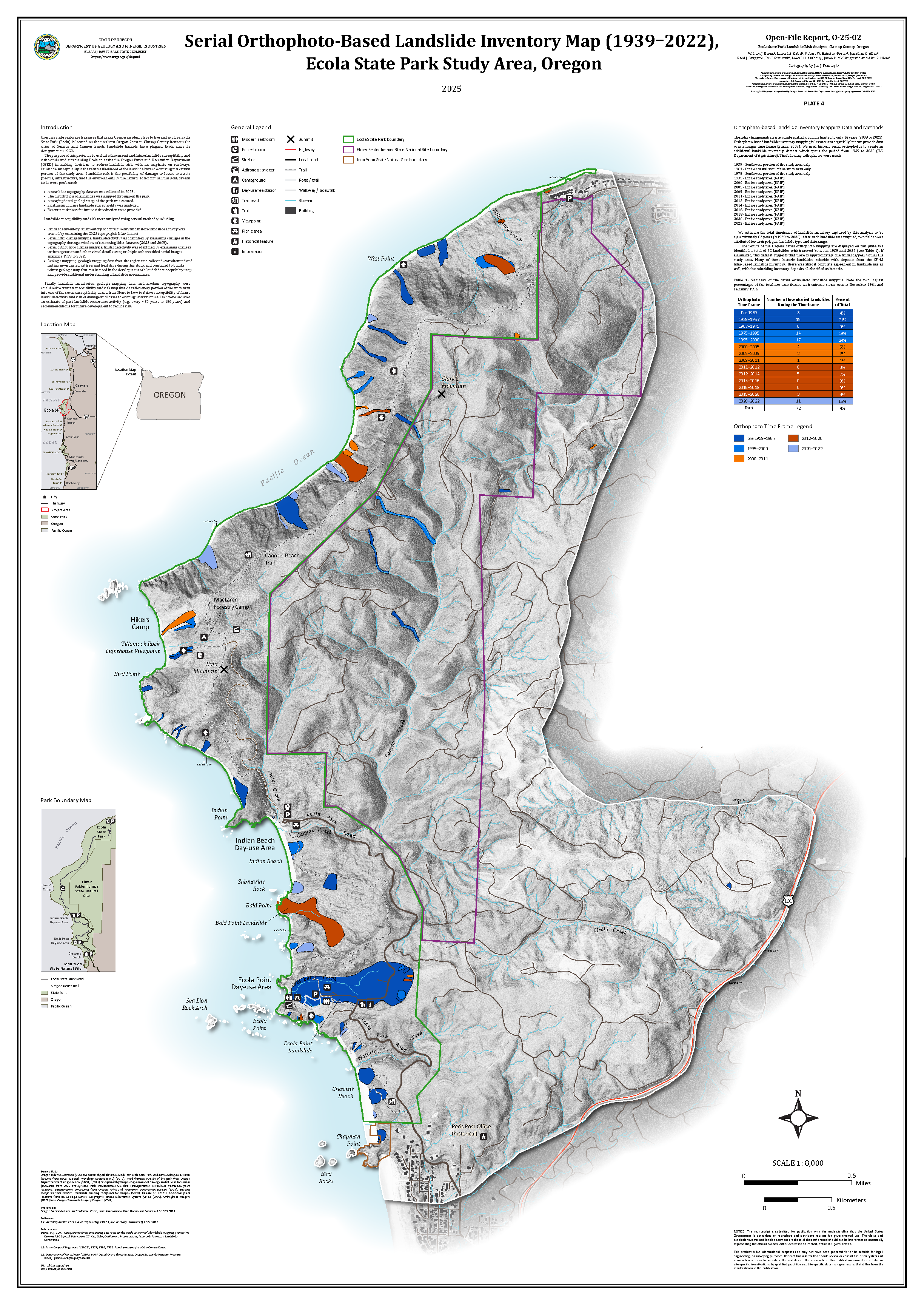
 Plate 5: Serial Lidar Landslide Inventory Map (2009-2023), Ecola State Park Study Area, Oregon (87.5 MB PDF)
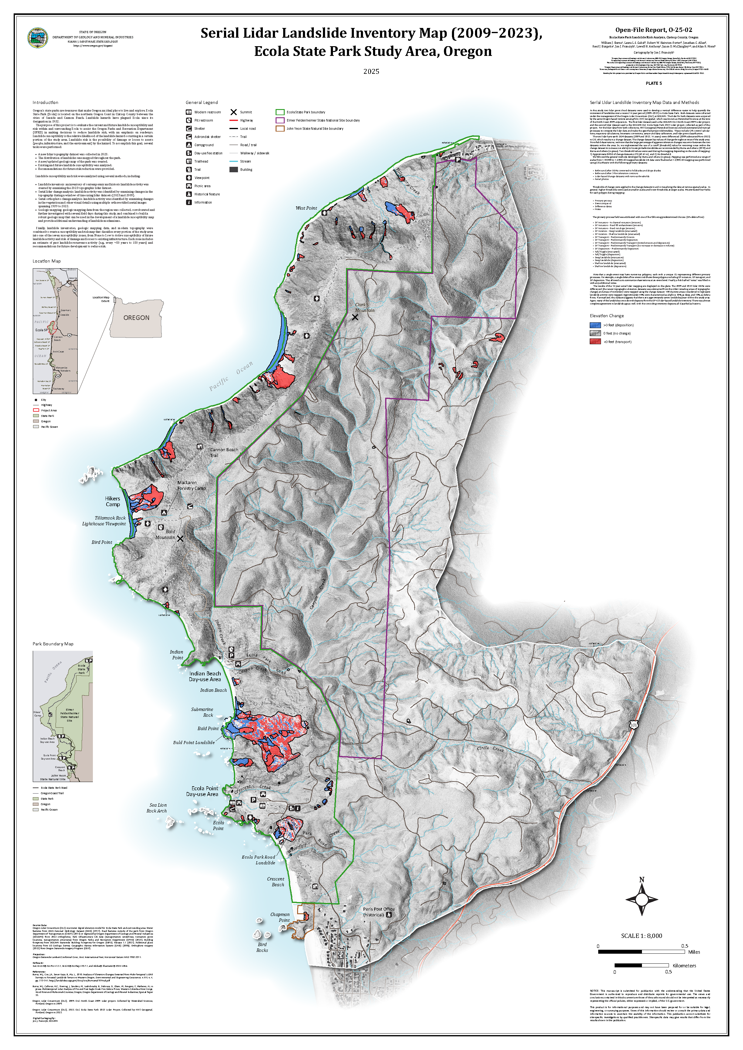
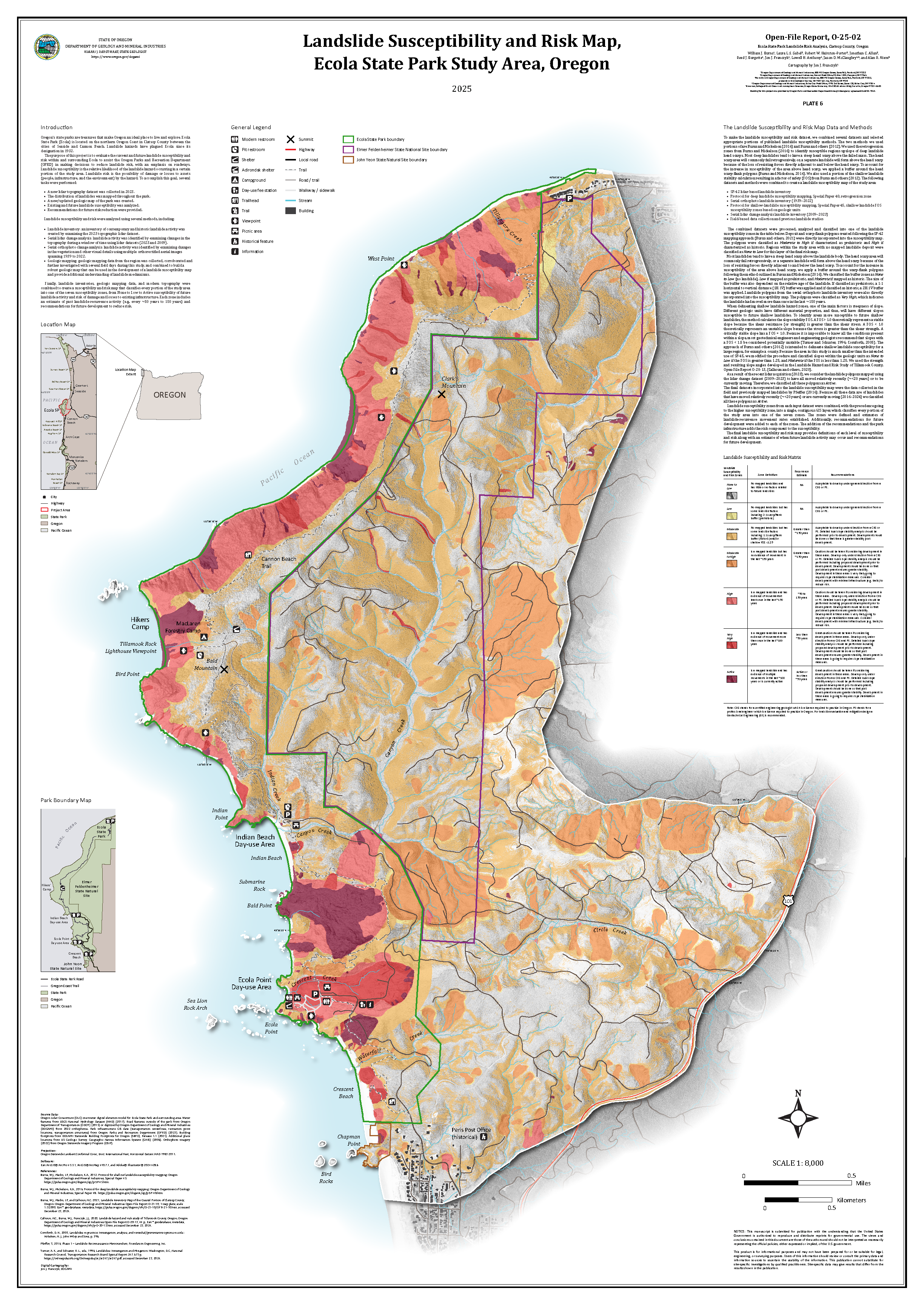
 Plate 6: Landslide Susceptibility and Risk Map, Ecola State Park Study Area, Oregon (95.8 MB PDF)