DOGAMI OPEN-FILE REPORT SERIES
Publication Preview
DOGAMI Open-File Report O-25-10, Channel Migration Zone Maps for Umatilla River and Lower McKay Creek, Umatilla County, Oregon, by Christina A. Appleby, Lowell H. Anthony, and Jesse K. Noone; 78 p. report, 19 p. appendix, two .xlsx spreadsheets, one Esri® geodatabase with internal metadata, external metadata in .xml format.
WHAT’S IN THIS REPORT?
This study provides Oregon communities with new information about the natural hazards from channel migration. During 2024 and 2025, the Oregon Department of Geology and Mineral Industries (DOGAMI) produced channel migration zone (CMZ) maps for the Umatilla River and lower McKay Creek in Umatilla County. At the same time, the Department of Land Conservation and Development (DLCD) identified community-driven strategies for reducing risk associated with future channel migration.
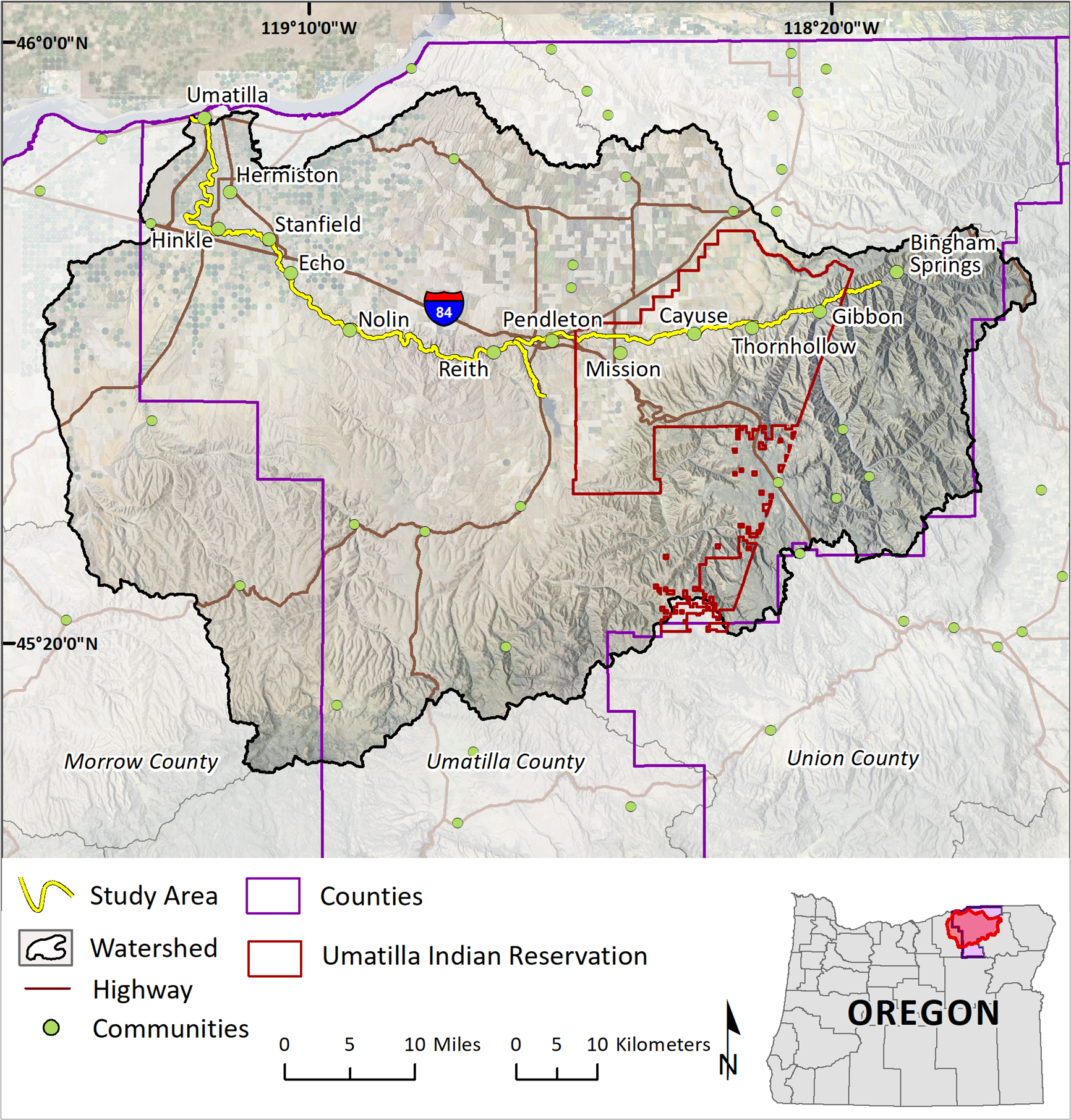
CMZ maps define the area in which a given stream is likely to move laterally and change its channel course within the next 30 and 100 years. In this study, CMZs were mapped along nearly 83 river miles (133 km) of the mainstem of the Umatilla River and 6 river miles (10 km) of lower McKay Creek (below the McKay Dam). The components that comprise these CMZ maps are the active channel (AC); historical migration area (HMA); 30-year high, 30-year medium, and 100-year low erosion hazard areas (EHAs); avulsion hazard area (AHA); and flagged streambanks. The method used derived primarily from the interpretation of historical aerial photographs, high-resolution lidar topography, geologic maps, and flood inundation maps.
The CMZ maps produced for this study of the Umatilla River and lower McKay Creek show that despite the modifications to the land and river by humans since the 1800s, nearly all the river segments (RS) along the Umatilla River and lower McKay Creek have experienced some degree of lateral migration during the last 72 years. Historical channelization; infrastructure such as levees, roads, railroads, dams, and bridges; and bedrock confine the channel and restrict movement. However, in areas where movement is not limited, the banks of the Umatilla River have eroded by hundreds of feet and the banks of lower McKay Creek have moved dozens of feet. Avulsions are common along the Umatilla River in the reaches upstream of the City of Pendleton, causing the river to rapidly move large distances across the floodplain. If the trend of river erosion and avulsions continues, people and infrastructure may be at risk.
CMZ maps are designed to aid in community planning, raise awareness of riverine flood and erosional hazards, and to inform decisions about environmental and emergency management and land use. The maps may be used to identify which buildings, critical facilities, transportation infrastructure, and utility lines are potentially at risk from channel migration and to prioritize areas for pre-disaster risk reduction. The strategies identified by DLCD to reduce risk and their recommendation for enhanced coordination may be found in the Appendix. The maps in this study do not replace a site-specific analysis by a land surveyor, geologist, engineer, or some combination thereof. These hazard maps will provide a timely and valuable resource for Tribal, county, and community planning efforts, including during the development of emergency plans and updates to Natural Hazard Mitigation Plans (NHMPs).
PUBLICATION DOWNLOADS
LOCATION MAP
PRESENTATION VIDEO
The following video comprises the joint DOGAMI–DLCD presentation reporting on this project. This material is also covered in the text report.