
Oregon State Flag An official website of the State of Oregon »

Ocean Planning

Ocean planning in Oregon is focused on protecting marine resources and the ecological functions that provide long-term economic and social benefits for all Oregonians. Maritime activities, like fishing, recreation, tourism, transportation, scientific research and education, traditional cultural practices, and sight-seeing are important to the State and local economies. The ocean is a large, publicly owned area where many different uses are supported. The goal of ocean planning is to reduce conflict between these wide ranging activities and ensure that they are carried out in a sustainable manner. Ocean users, along with state and federal agencies, are faced with the challenge of maintaining the health of the ocean ecosystem. Today, traditional uses of the ocean are increasing and new potential uses, such as renewable energy development and ocean aquaculture, are emerging.

Ocean Ownership and Management

On the land, plans and use regulations apply to both private and public lands. But the seafloor of the territorial sea, which extends seaward three miles from the ocean shore, is owned by the State of Oregon and managed as a public trust resource. Beyond the state's territorial sea, the area known as the outer continental shelf, which extends out to 200 miles, is controlled by the federal government. Managing the various natural resources of the ocean is the responsibility of a variety of state and federal agencies, each with different roles and responsibilities. To learn more about ocean management boundaries, click here to access an online learning tool provided by two federal ocean management agencies. Ocean planning by state agencies follows the policies and objectives of Statewide Planning Goal 19: Ocean Resources.

The Oregon Territorial Sea Plan provides the framework for state and federal agencies, as well as local governments and others, to manage ocean resources and activities through a comprehensive, coordinated and balanced process. In addition, the state legislature created an Ocean Policy Advisory Council (OPAC), whose members represent cities, counties, and ports, as well as recreation, fishing, and environmental and conservation interests. OPAC advises state agencies, the legislature, and the Governor's office on the management of ocean resources.

Our use of the ocean is changing, and climate change is affecting the balance of ocean communities. Therefore, the ocean that we have depended on is beginning to shift which affects important marine resources. This creates uncertainty for ocean users and coastal communities. The Oregon Coastal Management Program uses a balanced approach to decision making and considers public input, scientific research, and the results of ocean monitoring, as part of its process.

Below is a list of publications and information resources available to policy makers when considering new ocean policy or management program changes.

Oregon Ocean Information Website

The Oregon Ocean Information website was created to support policy decision making and changes to Oregon's Territorial Sea Plan. It also serves as a single go-to site for other ocean-related activities, councils, GIS data and online mapping tools, like Ore​gon SeaSketch. It is the web site for the Ocean Policy Advisory Council and the Ocean Acidification and Hypoxia Coordination Council.​

Oregon Territorial Sea Plan

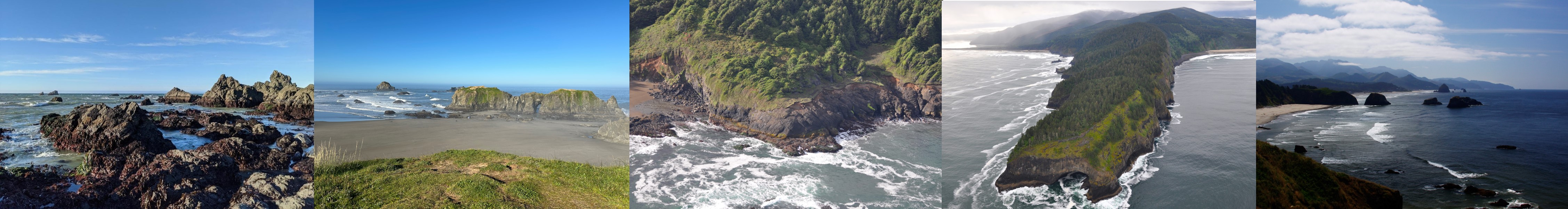
Oregon has jurisdiction over a strip of ocean water adjacent to the shore that is three nautical-miles wide, called the Territorial Sea. Oregon has a Territorial Sea Plan for this area which applies to state and federal agency programs and activities that take place there. Go to the Territorial Sea Plan page​ for more information.

The Ocean Plan

The Oregon Ocean Resources Management Plan, commonly referred to as the "Ocean Plan", was approved on December 12, 1990, by the Land Conservation and Development Commission. State law states that "the Territorial Sea Plan shall be based on the policies and recommendations of the Oregon Ocean Resources Management Plan." Learn more about the Ocean Plan and download a copy here.

The Ocean Book

The Ocean Book was written by Tish Parmenter and Bob Bailey and published in 1985. It focuses on the ocean environment: from the coastline to roughly 200 miles offshore, from Cape Mendocino, California to Vancouver Island, British Columbia. The Ocean Book brings together basic oceanography and research data to describe Oregon's ocean.

Ocean Policy Email Listserv

DLCD manages an email service that provides users ocean policy-related public notices and general information. It also includes details on upcoming OPAC meetings and events. Sign ​up here​.

Special Topics in Ocean Planning

Managing Oregon's rocky coastline is a shared responsibility. In fall 2020, DLCD will continue to pursue an amendment to the Rocky Shores management chapter (Part III) of the Oregon Territorial Sea Plan (TSP).  ​

To learn more and participate in the amendment process please visit the Oregon Ocean Information website.  ​

The plan acts as a coordinated vision for Oregon coastal resources and guides the actions of state and federal agencies that are responsible for managing coastal and ocean resources in the public trust. The amended rocky shores plan will:

  • incorporate the best available science;
  • consider the needs, concerns, and values of Oregonians; and
  • provide a resilient coastal ecosystem and lasting opportunities for its users.

While the Land Conservation and Development Commission (LCDC) is the entity responsible for approving amendments to the TSP, the amendment process is led by OPAC and its working group. See the following page for more information.

OPAC Rulemaking Information

Oregon's territorial sea has been identified as a favorable location for siting renewable energy facilities for research, demonstration and commercial power development. These facilities may vary in the type and extent of the technologies used and will require various equipment to be connected and attached to the seafloor. Then energy can be transferred to a power substation on land. Oregon requires proper siting and development of these facilities in order to minimize damage to natural resources or conflicts with other existing ocean uses. These actions will reduce or avoid adverse effects on marine ecosystems and coastal communities.

In 2019, the state amended the Territorial Sea Plan (TSP) to add a chapter about the development of marine renewable energy within state waters.  To learn more about the plan for managing the TSP for marine renewable energy read Part Five or visit https://www.oregonocean.info.

Outside of state waters, regulatory authority for the development of marine renewable energy is shared by the Federal Energy Regulatory Commission and the Bureau of Ocean Energy Management. However, OCMP may review these proposals based upon the approval by NOAA of a Geographic Location Description (GLD).To learn about GLDs, visit our Federal Consistency page.

DLCD is also helping to led a study (the Oregon Renewable Energy Siting Assessment​) on the siting of potential renewable energy development across the state with the Oregon Department of Energy.  Visit our Renewable Energy Page for more information.

A marine reserve is an area within Oregon's Territorial Sea or adjacent rocky intertidal area that is protected from all extraction activities. This includes the removal or disturbance of living and non-living marine resources, except as necessary for monitoring or research to evaluate the marine reserve condition, effectiveness, or impact of stressors (OPAC Policy Recommendations Document, 2008).

Oregon currently has five sites designated as marine reserves: Cape Falcon, Cascade Head, Otter Rock, Cape Perpetua, and Redfish Rocks. Each are named for local natural landmarks. Removal of marine life is prohibited, along with any type of ocean development.

The Oregon Department of Fish and Wildlife (ODFW) manages and monitors these five sites to gain a better understanding of marine reserve protections, our nearshore waters, and coastal communities. The ODFW Marine Reserves Program is located at the coast in Newport, Oregon, and employs six full-time staff.

For more information, go to:

Oregon Ocean Information web site, Marine Reserves

Oregon Marine Reserves web site (ODFW)

Through a statutory moratorium, Oregon prohibits oil and gas development within the Territorial Sea. In early 2018, the Bureau of Ocean Energy Management (BOEM) provided an opportunity for states to comment on the development of the U.S. Department of Interior's five-year National Draft Proposed Program for Oil and Gas Leasing on the Outer Continental Shelf for 2019-2024. In February 2018, Oregon provided a short letter stating a detailed set of comments was forthcoming. In March, a comprehensive 35-page letter was provided to BOEM that had comments from each affected state agency, including DLCD. The department is responsible for coordinating Oregon activities and will continue to participate in the BOEM leasing process. Our priority is for regulated activities to align with Oregon's ocean policies.

Contact

Andy Lanier
Marine Affairs Coordinator
andy.lanier@dlcd.oregon.gov
Phone: 503-206-2291