Earthquakes in Oregon
 The earthquake program at DOGAMI focuses on providing better seismic hazard and risk information, educating Oregonians, and partnering with federal, state and local governments, private organizations, and citizens to mitigate the hazards and risk.
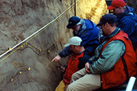
Earthquake hazards have been recognized as one of the major natural hazards in Oregon since the late 1980s, a result of the geologic research to identify and characterize the Cascadia subduction zone and crustal faults. The March 1993 Scotts Mills earthquake (M5.6) and the September 1993 Klamath Falls earthquakes (M5.9 and M6.0) demonstrated the potential hazards of crustal earthquakes in Oregon. Because of Oregon’s short history in dealing with seismic hazards, many fundamental issues, such as crustal fault activity and ground motion attenuation from subduction zone earthquakes, are still not well understood.
The amount of damage sustained by a building during a strong earthquake is difficult to predict and depends on the size, type and location of the earthquake, the characteristics of the soils at the building site, and the characteristics of the building itself. At present, it is not possible to accurately forecast the location or size of future earthquakes. It is possible, however, to predict the behavior of the soil (soil means the relatively loose and soft geologic materials that typically overlie solid bedrock in the Northwest) at any particular site. In fact, in many major earthquakes around the world, a large amount of the damage has been due to the behavior of the soil.
Earthquakes come from four different sources: crustal, subduction zone, intraplate, and volcanoes. The most common are crustal earthquakes, which occur along faults, or breaks in the earth’s crust, at shallow depths of 6-12 miles (10-20 km) below the surface. The two largest earthquakes in recent years in Oregon, Scotts Mills (magnitude 5.6) and the Klamath Falls main shocks (magnitude 5.9 and magnitude 6.0) of 1993 were crustal earthquakes.
Great subduction zone earthquakes occur around the world where the tectonic plates that make up the surface of the earth collide. When these plates collide, one plate slides (subducts) beneath the other, where it is reabsorbed into the mantle of the earth. This sloping boundary between the two plates is the site of some of the most powerful earthquakes ever recorded, often having magnitudes of 8 to 9 or larger.
Better Information
Seismic Hazard Mapping -
Seismic hazards in urban areas are affected by the local geologic, hydrologic, and topographic conditions. DOGAMI maps these hazards in communities in Oregon.
Seismic Risk Assessment -
FEMA's Hazus hazard identification software provides a powerful tool to estimate the physical and economic impact of future earthquakes in Oregon and has served as a catalyst for discussion, planning and mitigation. DOGAMI provides county level risk assessments that incorporate ground motion amplification, liquefaction potential, and earthquake-induced landslide maps using Hazus. DOGAMI is also working on building inventory improvements.
Education
Intensive public education efforts along the coast of Oregon have resulted in an increased understanding of the earthquake and tsunami threat by local governments, businesses and the general public. DOGAMI and Oregon Emergency Management have provided the expertise and hardware for coastal communities to designate tsunami evacuation routes. Local workshops, town-hall meetings, and press conferences continue to keep coastal residents informed with the latest information on earthquake, tsunami, and landslide hazards.
Partnerships
DOGAMI has formed partnerships with federal, state, and local governments, universities, private organizations, and concerned citizens to disseminate information on earthquake hazards and risks and to facilitate long range planning and mitigation.
Rapid Visual Screening and the Seismic Rehabilitation Grant Program
DOGAMI conducted preliminary seismic safety surveys of critical infrastructure buildings. Learn more about this project and see site reports
here.