Risk Assessments
The Oregon Department of Geology and Mineral Industries (DOGAMI) partners with FEMA Region 10 to provide multi-hazard risk assessments for communities.
Since 2008 DOGAMI has received grant funding through FEMA’s Risk MAP and Cooperating Technical Partners programs to develop tools that help communities understand risk related to flood, landslide, tsunami, and earthquake hazards. These tools are used to identify immediate mitigation needs and to guide long-term planning efforts.
Hazus
Hazus is a software tool used to estimate economic losses for floods and earthquakes. We make our estimates using hazard mapping developed in-house and local building data provided by communities. The results provide relative and absolute losses down to the building scale.
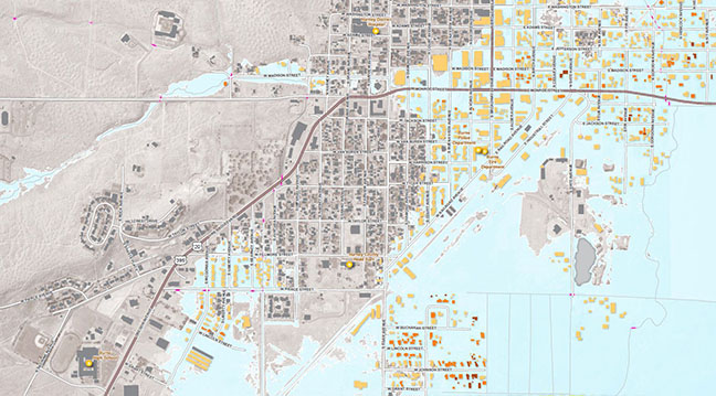 Example of mapped results of Hazus flood loss estimation.
Risk Assessment Projects
(last updated 07/27/2020)