DOGAMI OPEN-FILE REPORT SERIES
Publication Preview
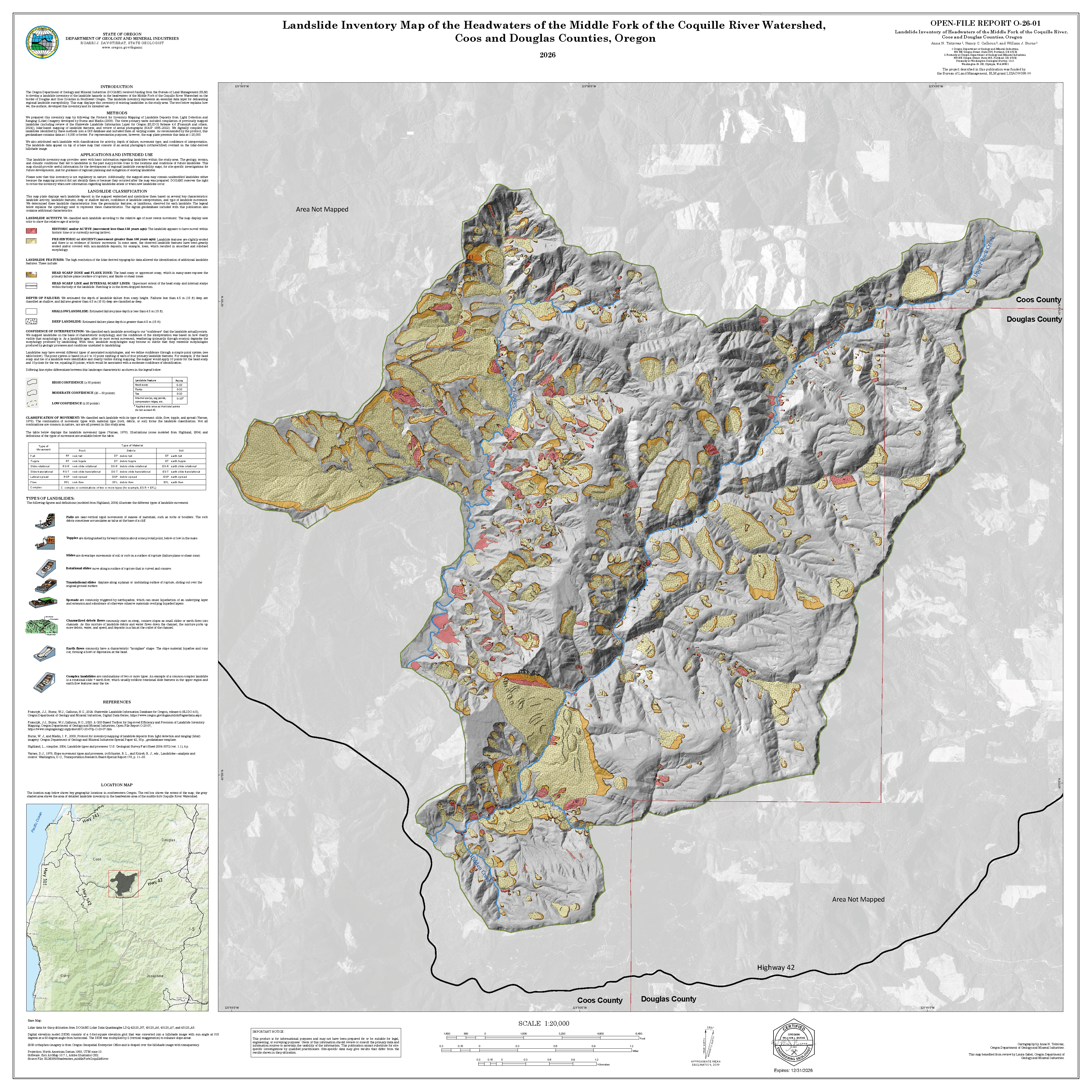
Open-File Report O-26-01, Landslide Inventory Map of the Headwaters of the Middle Fork of the Coquille River Watershed, Coos and Douglas Counties, Oregon, by Anna N. Tsitsivas, Nancy C. Calhoun, and William J. Burns; one map plate, one Esri® geodatabase with internal metadata, external metadata in .xml format.
What's in this report?
Landslides are one of the most widespread and damaging natural hazards in Oregon. This map is an inventory of existing landslides in the Coquille River Watershed and is an essential data layer for delineating regional landslide susceptibility. We prepared this inventory map by following the Protocol for Inventory Mapping of Landslide Deposits from Light Detection and Ranging (Lidar) Imagery developed by Burns and Madin (2009). This landslide inventory is not regulatory and DOGAMI reserves the right to revise this publication when new information regarding landslides is found or when new landslides occur.
This map plate displays each landslide deposit in the mapped watershed and symbolizes them based on several key characteristics: landslide activity, landslide features, deep or shallow failure, confidence of landslide interpretation, and type of landslide movement. Additional characteristics can be found in the digital geodatabase included with this publication. We determined these landslide characteristics according to the geomorphic features, or landforms, observed for each landslide.
Publication downloads
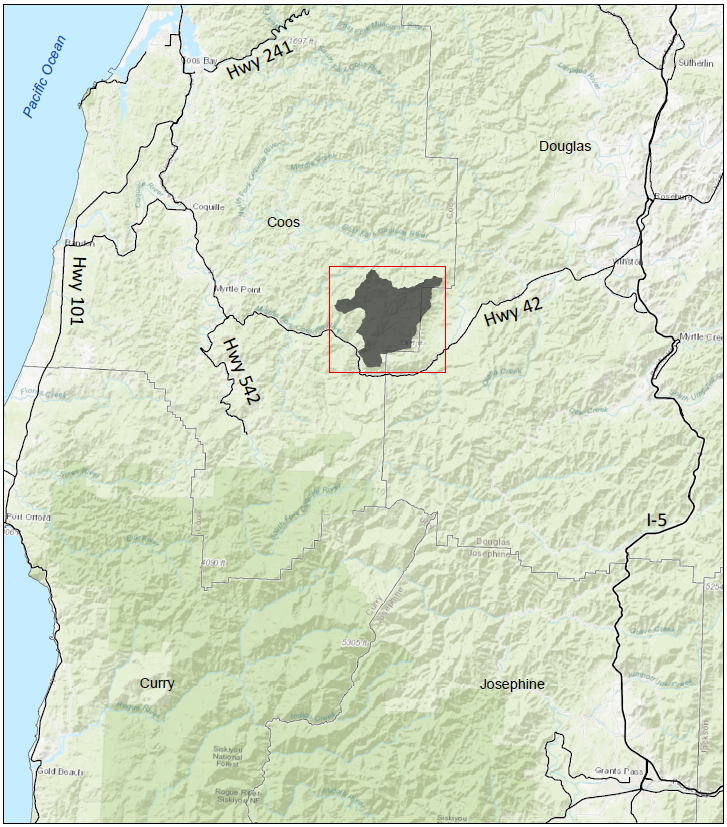
Location map
Geographic Informatoin System (GIS) Data
Geodatabase is Esri® version 10.7 format.
Metadata is embedded in the geodatabases and is also provided as separate .xml formatted files.
Each dataset listed below has an associated, standalone .xml file containing metadata in the Federal Geographic Data Committee Content Standard for Digital Geospatial Metadata format.
WHoodRiver_LandslideInventory.gdb
|
|
Feature Classes: |
Deposits
| | .xml
|
Scarp_Flanks
| Polygons
| .xml
|
Scarps
| Polylines
| .xml
|
Study Area
| Polygon
| .xml
|
Map plate (PDF Format)
Plate: Landslide Inventory Map of the Headwaters of the Middle Fork of the Coquille River Watershed, Coos and Douglas Counties, Oregon (21.4 GB PDF)