DOGAMI GEOLOGIC MAP SERIES
Publication Preview
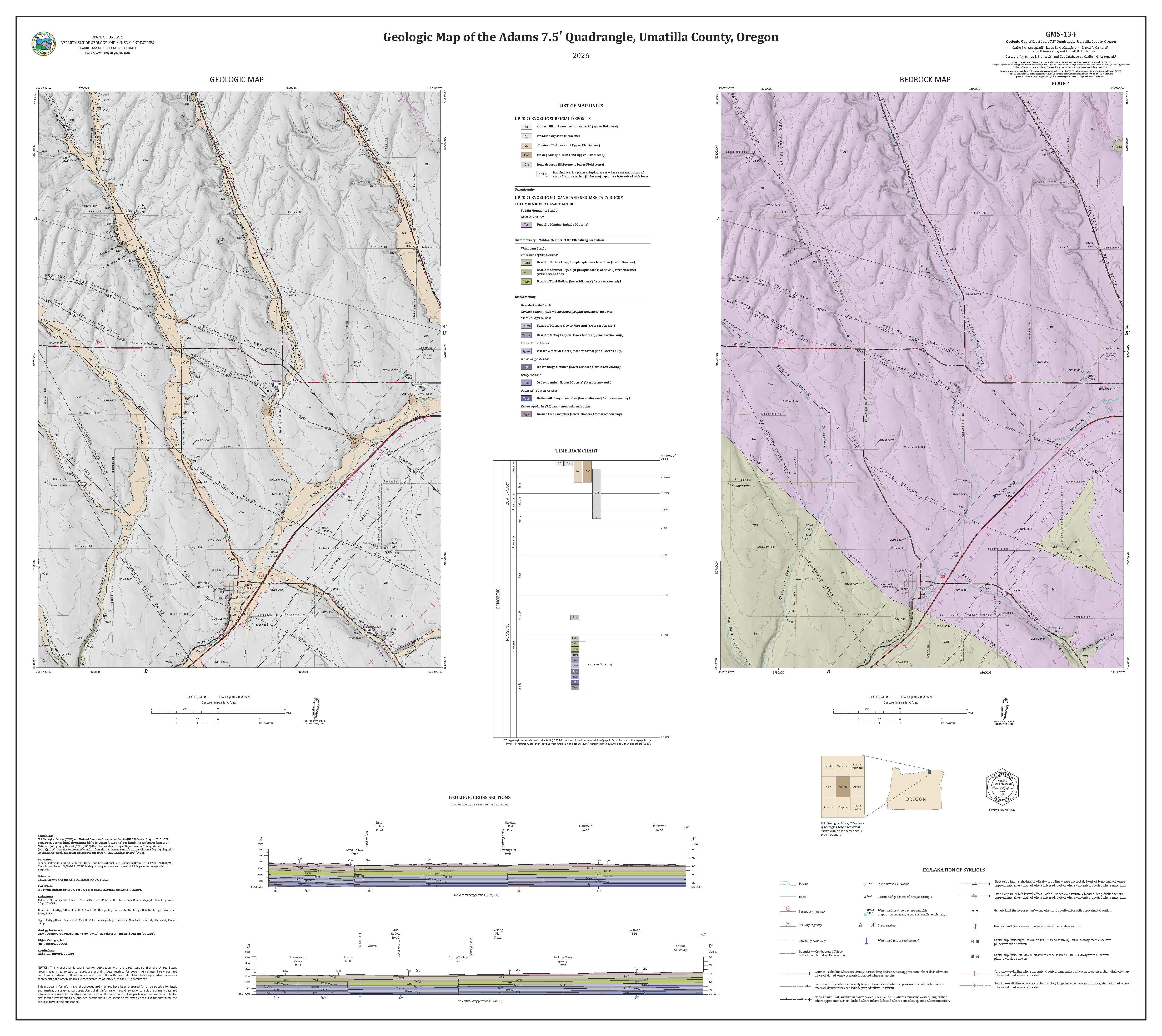
GMS-134,
Geologic Map of the Adams 7.5' Quadrangle, Umatilla County, Oregon by
Carlie J.M. Azzopardi, Jason D. McClaughry, David R. Gaylord, Eduardo F. Guerrero, and Lowell H. Anthony; 2 map plates (scale 1:24,000), including geologic map, bedrock map, cross sections, explanatory text, aeromagnetic survey data, ReMiQAQ® 2D velocity profiles, and results of geochemical analyses; Esri format geodatabase and metadata.
PUBLICATION DOWNLOADS
-
Map plates (41.57 GB .zip file) Geologic Map of the Adams 7.5' Quadrangle, Umatilla County, Oregon (42" x 58"; 7.3 GB) with geologic map, bedrock map, cross sections, explanatory text, aeromagnetic survey data, ReMiQAQ® 2D velocity profiles, and results of geochemical analyses
-
GIS metadata (134.85 MB .zip file)
-
Full GIS data bundle, geodatabase with metadata (Esri® version 10.7 format; 4.39 GB .zip file)
-
Complete publication bundle (map plates, geodatabase, metadata; 45.96 GB .zip file)
INTRODUCTION
The Adams 7.5′ quadrangle in Umatilla County of northeast Oregon includes an area of 134 square kilometers (km2) at the eastern edge of the Columbia Plateau, a broad depression forming the northwestern flank of the Blue Mountains. The oldest rocks in the map area are part of the ~17- to 6-million-year-old Columbia River Basalt Group (CRBG), a succession of tholeiitic basalt and basaltic andesite lava flows cropping out over more than 210,000 km2 in parts of Washington, Oregon, Idaho, and Nevada. The CRBG is largely overlain by Pleistocene to Holocene loess across the map area and Pleistocene and Holocene alluvial units on valley floors. Three major fault zones converge in this part of the Columbia Plateau, including the WNW-striking Wallula Fault Zone, NNW-striking Milton-Freewater Fault Zone, and the NNE-striking Hite Fault Zone.
The Oregon Department of Geology and Mineral Industries (DOGAMI) mapped the geology and structure of the Adams 7.5′ quadrangle between 2021 and 2024. Detailed geologic mapping of the Adams 7.5′ quadrangle is a high priority for the Oregon Geologic Map Advisory Committee because it supports long term goals for conserving and sustaining water resources, as well as reducing risks from natural hazards such as earthquakes. Our mapping was supported in part by a grant from the STATEMAP component of the U.S. Geological Survey (USGS) National Cooperative Geologic Mapping Program (NCGMP) under cooperative agreement G22AC00304. The State of Oregon provided additional funds through DOGAMI.
The chief objective of this investigation is to provide an updated and spatially accurate geologic framework for the area as part of a multiyear study of the geology of the larger Walla Walla River basin. Additional key objectives of this project are to 1) map individual CRBG lava flows and crosscutting faults to determine lava flow distribution, fault offset, fault history, and possible earthquake hazards in this part of the Walla Walla River basin of northeast Oregon, and 2) characterize the stratigraphic framework and geologic conditions controlling the distribution of water resources within the CRBG. CRBG-hosted aquifers provide a critical water supply in the map area and more widely across the Pacific Northwest. Textural and geochemical analysis of cuttings obtained from several water wells drilled in the greater Milton-Freewater-Athena-Adams-Helix area provides new information essential for improving interpretations of the subsurface CRBG stratigraphy and structural geology of the region.
GEOGRAPHIC INFORMATION SYSTEM (GIS) DATA
Geodatabase is Esri® version 10.7 format.
Metadata is embedded in the geodatabase and is also provided as separate .xml formatted files.
MAP PLATES (PDF Format)
Plate 1.
Geologic Map of the Adams 7.5' Quadrangle, Umatilla County, Oregon, scale 1:24,000 (46" x 41"; 9.55 GB PDF)
Plate 2. Explanatory text, aeromagnetic survey data, ReMiQAQ® 2D velocity profiles, and results of geochemical analyses for the Adams 7.5' Quadrangle, Umatilla County, Oregon (56" x 46"; 34.18 GB PDF)