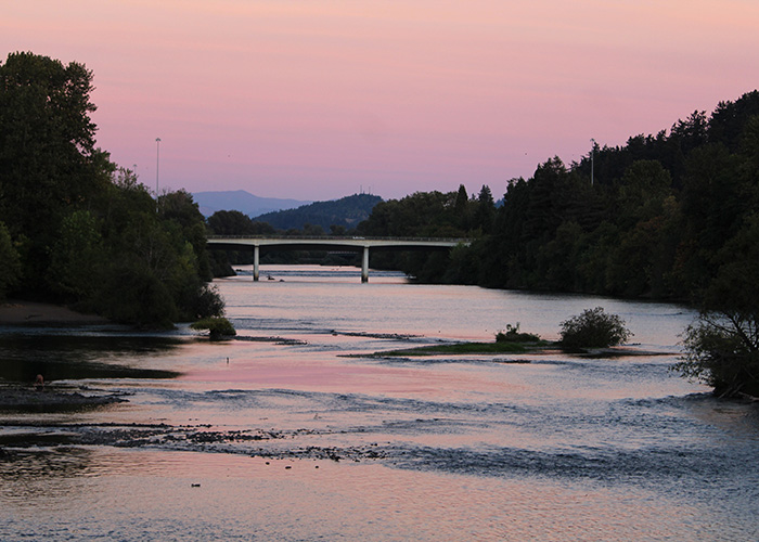
Goal 15 is focused on the Willamette River, and applies to cities and counties along the river. The Willamette River Greenway is a corridor of water and land in which development is planned and built with recognition of the unique qualities of the Willamette River. The Goal set tasks for both the state and local communities.
Cities and counties adopted local greenway plans, along with criteria for new development, new uses, and the increase of uses along the river. Goal 15 also called for the state plan and local plans to identify parcels that might be acquired for the purpose of increasing the amount of park land near the river. In the early days of the Greenway, state funding was dedicated to such acquisitions. This funding however, was not maintained. Today, Goal 15 is largely implemented through local comprehensive plans and codes. The state plays a part if local governments propose changes to their local greenway plans.
History of the Willamette River Greenway
The idea of a greenway along the Willamette River has its origin in legislation proposed by Governor Tom McCall in 1967. His goals were similar to those that resulted in the protection of Oregon beaches for public use. But private property owners along the river were not supportive of this idea and funding for the purchase of new lands for public parks and trails along the river did not last.
Goal 15 reflects the original intent of Governor Tom McCall. Some of the inventories called for in the Goal were to lay the groundwork for a long-term effort to increase public access and enjoyment of the river. The fruits of Governor McCall's vision can be seen in the existing network of state parks and in local plans that prioritize the acquisition of land and easements along the river to extend and connect bike and pedestrian paths. For people who experience the river by boat, the Goal 15 standards for keeping structures away from the river preserve access to the river’s banks.
State Greenway Boundary
The State Greenway Boundary was established with input from Oregon State Parks (which at that time was part of the Department of Transportation), DLCD, and local governments. It was identified and adopted in the 1980's. Since then, only a few small changes have been made to the boundary. The State Greenway Boundary is a composite of all the individual boundary segments identified in city and county comprehensive plans. The Greenway includes both the land and the water within the boundary. Any proposed change in the boundary must be reviewed by the Land Conservation and Development Commission and approved by Oregon Department of Parks and Recreation. Changes to zoning designations within the Boundary must be consistent with Goal 15.
Local Greenway Plans and Compatibility Review
Much of the current implementation of Goal 15 rests with cities and counties along the Willamette River. Each jurisdiction has a Greenway section within their comprehensive plan, and local development code standards, which implement their greenway plan. These plan and code elements were reviewed and acknowledged by the
Land Conservation and Development Commission (LCDC) when the local jurisdictions adopted their original comprehensive plans. Any changes to local plans or codes have been either: reviewed and acknowledged by LCDC during a subsequent
periodic review of their comprehensive plan; or reviewed for consistency with Goal 15 by DLCD as part of a
post acknowledgement plan amendment. For the most part however, cities and counties implement their greenway plans and codes without DLCD involvement.
Local greenway compatibility review is the most common action taken to implement Goal 15. For many jurisdictions greenway compatibility standards are applied to development anywhere within the State Greenway Boundary. New development, new uses along the river, and the increase of a use, must follow standards designed to maintain physical and visual access to the river, preserve habitat and vegetation near the river, and to direct development away from the river. Directing development away from the river does not mean development is prohibited. It means that the site design needs to provide open space and access as appropriate to the situation. Local codes also have standards to preserve the visual experience of people recreating on the river and a specified structural setback distance to preserve access to the river's bank from the water.
Original Adoption: 12/6/75; Effective: 12/24/75
Amended: 12/4/80; Effective: 12/17/80
Amended: 2/17/88; Effective: 3/31/88
Amended: 3/21/08; Effective: 4/18/08
 Read full text version of Goal 15
Administrative Rules that implement Goal 15:
660-020 – Willamette River Greenway Plan