Oregon's designated coastal zone stretches from the Washington border on the north, to the California border on the south; bound on the west by the extent of the state's territorial sea (generally 3 nautical miles offshore), and extending east to the crest of the Coast Range. There are a few exceptions to the eastern boundary: (a) the Columbia River, where the coastal zone extends to the downstream end of Puget Island; (b) the Umpqua River, where the coastal zone extends to Scottsburg; and (c) the Rogue River, where the coastal zone extends to Agness.
By law, Oregon's coastal zone excludes federal lands within it for federal consistency purposes. However, federal consistency will apply if a project located on excluded federal land affects coastal uses or resources outside of the federal lands.
Federal consistency applies to any project that affects a coastal use or resource, whether inside or outside of the coastal zone boundary. However, if a project is located outside of the coastal zone and has 'reasonably foreseeable' impacts on the coastal use or resource, there are different processes and requirements that DLCD must meet in order to review it.
Geographic Location Descriptions
One of the requirements that DLCD must meet in order to have the authority to review a federal activity outside of the coastal zone, is to create a spatial boundary illustrating where DLCD would like to have the authority to review specific activities. These predetermined spatial boundaries that are activity-specific, are called Geographic Location Descriptions (GLDs). Currently, Oregon has one GLD and it is described below. New GLDs can be proposed at any time for incorporation into the Oregon Coastal Management Program (OCMP), and are the result of collaborative work between the OCMP and partner state agencies.
If Oregon does not have a GLD for an activity outside of the coastal zone that we'd like to review, we must submit a request to NOAA to do so.
Oregon Marine Renewable Energy GLD
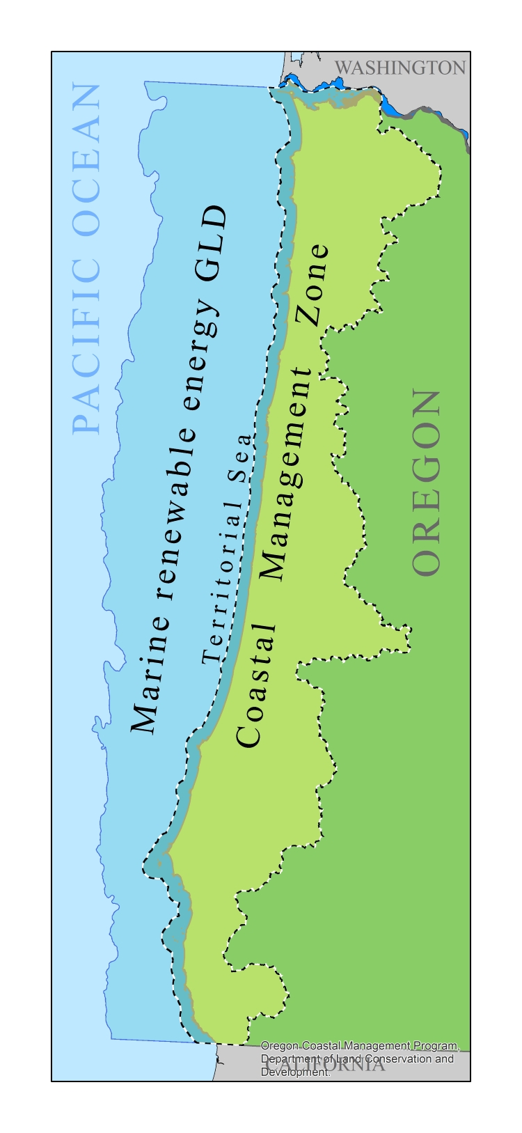
 Oregon's Marine Renewable Energy GLD is an area starting from the seaward limit of Oregon state jurisdiction (3 nautical miles (nm) from the shoreline) and extending seaward to a boundary line along the outer continental shelf which approximates the 500 fathom bathymetric contour. The OCMP has on file a list of geographic coordinates that form the GLD boundary line, and can make these available on a project by project basis.
Within this GLD, federal consistency review will automatically take place for the licenses and permits listed in Table 7 when they are related to the following activities:
- Any offshore wind or wave power generation facilities or structures(s), of a permanent nature, regardless of size or number;
- Underwater cables to service power generating facilities; and
- Research and monitoring devices such as LIDAR, Met towers or wave energy measurement instruments with a deployment window of 5 years or greater.
Oregon's Marine Renewable Energy GLD is designed to ensure that any marine renewable energy projects within the area are automatically subject to the federal consistency review process, so that federal activities such as the leasing and permitting authorized by the federal Bureau of Ocean Energy Management (BOEM), are consistent with the enforceable policies of Oregon's Coastal Management Program.
Geographic Location Description Informational Document
for Practitioners
The OCMP has also developed an informational document in collaboration with content experts to assist coastal programs in the development of GLDs. The information within this document is based on the experiences of multiple Coastal Zone Management Programs and does not necessarily represent the views of NOAA. It is not a NOAA document or NOAA guidance.
Access the GLD Pathways and Considerations Document here
(Version 2, December 2022)
Coastal Programs staff can contribute to this living document by contacting coast.permits@dlcd.oregon.gov. The document will be updated through time to incorporate additional experience and knowledge regarding the development of GLDs.
The OCMP thanks the many contributors who shared their knowledge and experiences, making this valuable resource possible.