Surveying in the Cloud
The Oregon Department of Transportation currently operates a Leica Pegasus:Two mobile scanner to gather survey grade data. The scanner generates a point cloud that accurately measures and models existing roadway conditions. This information can be used for: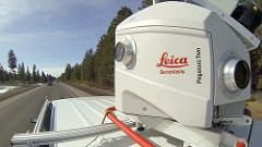
- Project development.
- Asset management.
- Pavement evaluation.
- Slide monitoring.
- Accident reconstruction.
ODOT is exploring how mobile scan data can complement data collection throughout the agency.
Along with the point cloud, the Pegasus:Two provides 360 degree digital imagery and has an optional downward facing pavement camera. It can be mounted on a variety of vehicles to easily complete otherwise labor intensive surveys.
The long term vision for this technology is to provide a real time digital transportation system that provides a holistic view of transportation network assets.
Practical Uses for Mobile Mapping
ODOT used mobile mapping to evaluate those roadways impacted by the 2015 speed change law.
Cannot retrieve the URL specified in the Content Link property. For more assistance, contact your site administrator.