Get Your Oregon Coast Tsunami Evacuation Map
Choose from the series below for the scale, format, and detail that work best for you.
All the map series use the same data for tsunami inundation zones.
1. NVS Online Tsunami Evacuation Zone Viewer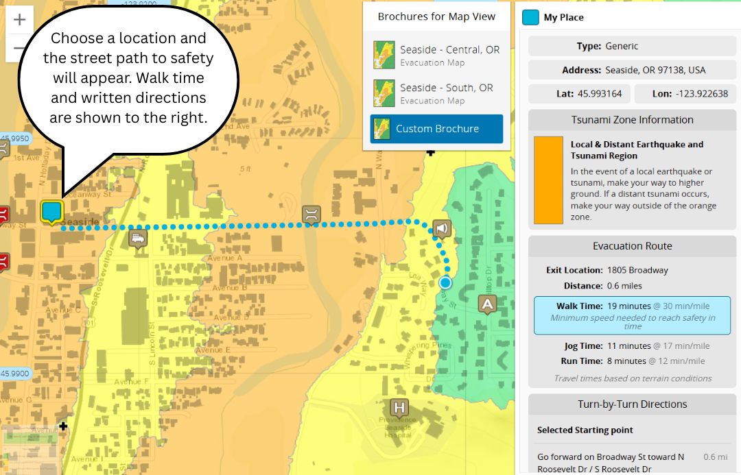
The
NVS Online Tsunami Evacuation Zone Viewer covers the entire coast of Oregon and Washington. You can use this viewer to do the following:
- Make and print a custom map
- Search by address or coastal area
- Find the shortest street route to safety for Seaside, Rockaway Beach, Pacific City, and Coos Bay (part of a pilot project). The speeds and times provided for these street routes are for the worst case local tsunami scenario.
2. Tsunami evacuation maps of the Oregon coast
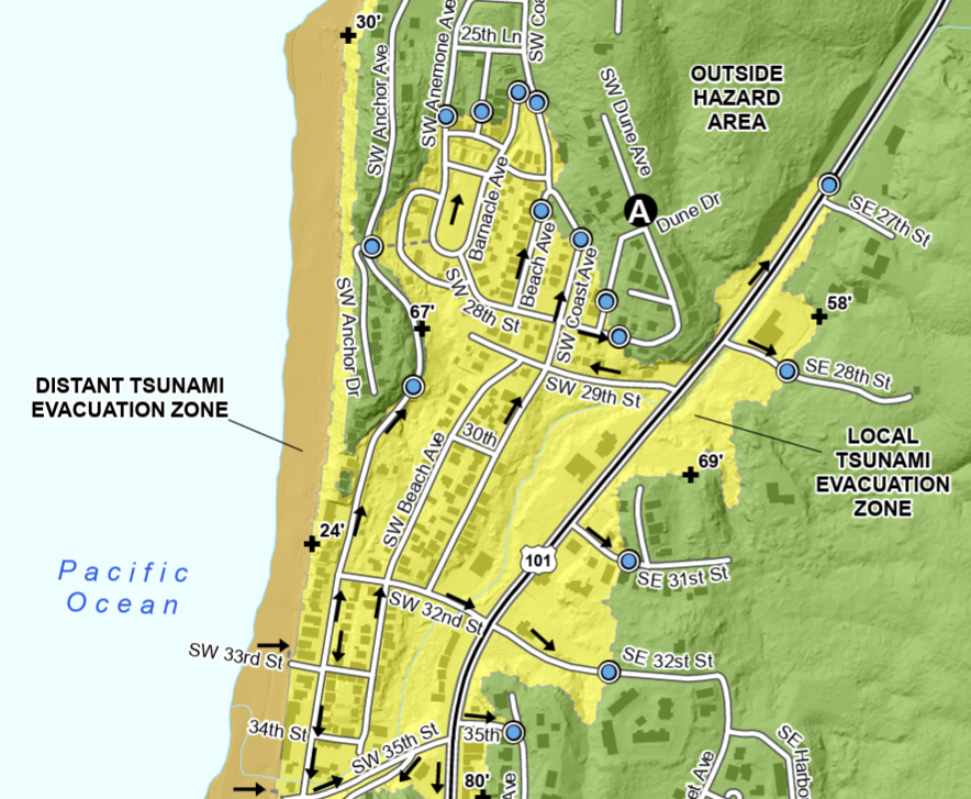
The Oregon Tsunami Clearinghouse Tsunami Evacuation Maps provide tsunami evacuation routes for specific coastal neighborhoods. Here you can find the following:
- Neighborhood-specific evacuation maps showing the expected tsunami inundation for tsunami events that are local (Cascadia) and distant (Alaska) and how they are predicted to impact the Oregon Coast
- Printable, page-size PDFs
3. "Beat the Wave" evacuation route maps
- Printable, page-size PDFs for all Oregon Coast communities
- Needed speeds (walk, jog, or run) and best general route to reach the nearest assembly area
4. Large-Extent Tsunami Evacuation Maps
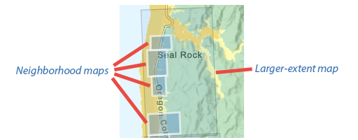
Large-scale tsunami evacuation maps are also available for most Oregon coastal communities through the Oregon Tsunami Clearinghouse. These are area maps of various scales and dimensions and were originally delivered to county emergency managers