Beat the Wave Technical Reports & Maps
If you are looking for "Beat the Wave" Tsunami Evacuation
Route Maps, go
here
When the next great Cascadia Subduction Zone earthquake and tsunami occur, coastal residents and visitors will have 10-30 minutes to reach safety. Evacuation on foot will be the only means possible. To be prepared, people need answers to questions:
- What are the most efficient roads and trails to take to reach safety?
- How fast will people have to travel to beat the wave to safety?
- Will the earthquake cause bridges to become impassable or activate a landslide that blocks an escape route?
- If safe evacuation isn't feasible, what other preparations can be made?
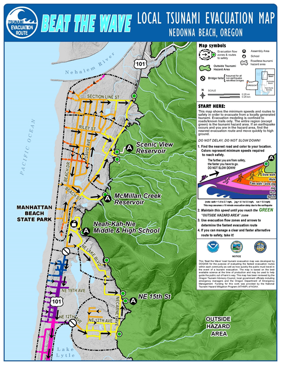
What do Beat the Wave technical maps look like?
The maps show the same green safety areas as on DOGAMI's
tsunami evacuation maps, with the addition of arrows that indicate the most efficient routes. The quickest route may not be the obvious one, so it pays to study the map and practice your route. Colors on the maps show
the speed that must be maintained from the starting point until safety is reached.
Which communities have maps?
To date, we have completed Beat the Wave modeling for
unincorporated Tillamook County communities;
Astoria;
Cannon Beach, Arch Cape, and Falcon Cove;
Coos Bay estuary communities;
Gold Beach;
Lincoln City and unincorporated Lincoln County;
Nehalem Bay;
Newport;
Pacific City;
Port Orford;
Reedsport and Florence;
Rockaway Beach;
Seaside and Gearhart; and
Warrenton/Hammond/Clatsop Spit
What other data products are available with the reports?
The reports include technical information about how the maps are made and GIS data; some reports include alternate scenarios such as: