Get to Know the Region
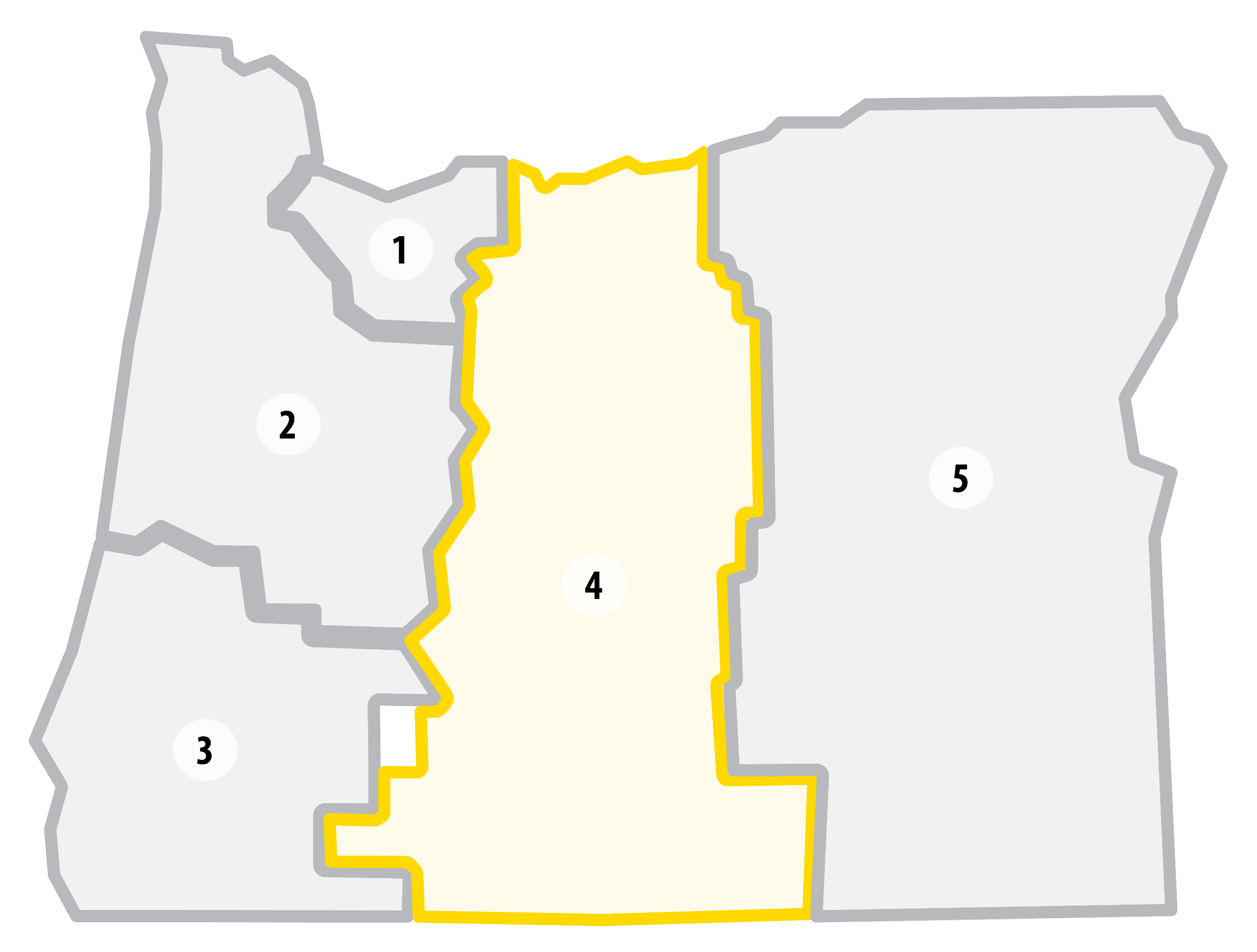 Region 4 builds, operates and maintains the state’s multimodal transportation system for central Oregon.
This region spans the east slopes of the Cascades to Arlington, Mitchell and Adel; and from the Columbia River to the north all the way to the California and Nevada state lines to the south.
Region 4 serves the residents of Wasco, Sherman, Gilliam, Jefferson, Wheeler, Crook, Deschutes, Lake and Klamath Counties, and partners with the Confederated Tribes of Warm Springs and the Klamath Tribes.
Running through the middle of the state, Region 4 includes major tourist destinations including the scenic Columbia River Gorge, Mount Bachelor and the Cascade Lakes, the Klamath Basin and the state’s only national park, Crater Lake.
The high desert terrain and mountain regions create geographic and climate challenges in managing rural state highways and two major freight corridors — I-84 and US-97. This includes increasingly severe fire seasons in the summer, extreme winds, landslides and rockfalls, and more winter snow on average than other regions. The public counts on safe and reliable passage through mountain passes to travel in and out of the region for recreation, commerce and other needs.
Key Stats
Lane Miles: 4,166
Bridges: 291
Highlighted Projects for 2027-2030
We've selected a few Region 4 projects as examples of the type of work you can expect from this STIP cycle.
OR 39 N Klamath Falls Interchange to S 6th Street


 U.S. 26 Wapinitia Pass – Warm Springs
 U.S. 20 and U.S. 395: Silver Creek Bridges

 I-84 Kaser Ridge Rockfall
OR 126 Evergreen Ave- Oasis Village (Redmond)
I-84 Kaser Ridge Rockfall
OR 126 Evergreen Ave- Oasis Village (Redmond)